Shipping
Shipping is not included in the prices. The fee will be confirmed to the customer by a separate e-mail and depends on the parcel's size and destination.
Examples: Finland 5,90€; Sweden, Germany, Baltics 8,00€; Benelux, Denmark, Spain 12,00€; Non-EU 35,00€
terms & conditions
Before ordering we kindly ask you to read our terms and conditions.
availability
The selection of our online store is not available at the bookstore. If you wish to view some items, please contact us in advance.
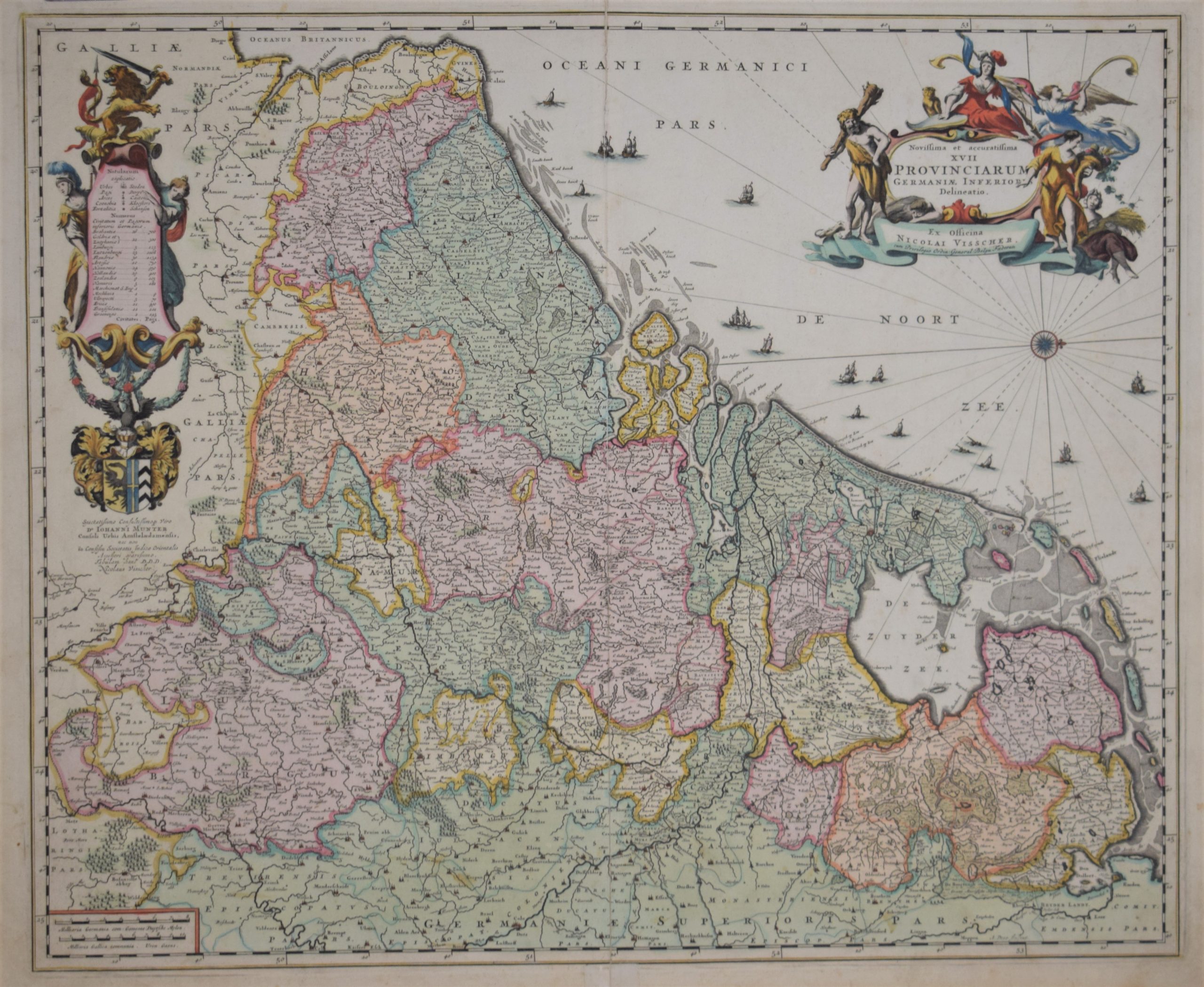
Visscher, N.: Novissima et accuratissima XVII Provinciarum Germaniae Inferior Delineatio
€1.500,00
Description
Nicolaus Visscher (1618-1709)
Novissima et accuratissima XVII Provinciarum Germaniae Inferior Delineatio, Ex Officina Nicolai Visscher.
17th century map of the Low Countries: Holland, Belgium and Luxembourg.
Hand-coloured copper engraving with lots of details and placenames. Decorative cartouche.
| Year of printing | 1684 |
|---|---|
| Place of printing | Amsterdam |
| Technique | kuparipiirros / kopparstick / copper engraving |
| Illustrations | käsin värjätty / handkolorerad / hand-coloured |
| Dimensions | 46 x 56 cm |
| Condition | 3 |
| Condition explanations | (5) Mint, (4) Very good, (3) Good, (2) Fair, (1) Poor |
Additional information


