Shipping
Shipping is not included in the prices. The fee will be confirmed to the customer by a separate e-mail and depends on the parcel's size and destination.
Examples: Finland 5,90€; Sweden, Germany, Baltics 8,00€; Benelux, Denmark, Spain 12,00€; Non-EU 35,00€
terms & conditions
Before ordering we kindly ask you to read our terms and conditions.
availability
The selection of our online store is not available at the bookstore. If you wish to view some items, please contact us in advance.
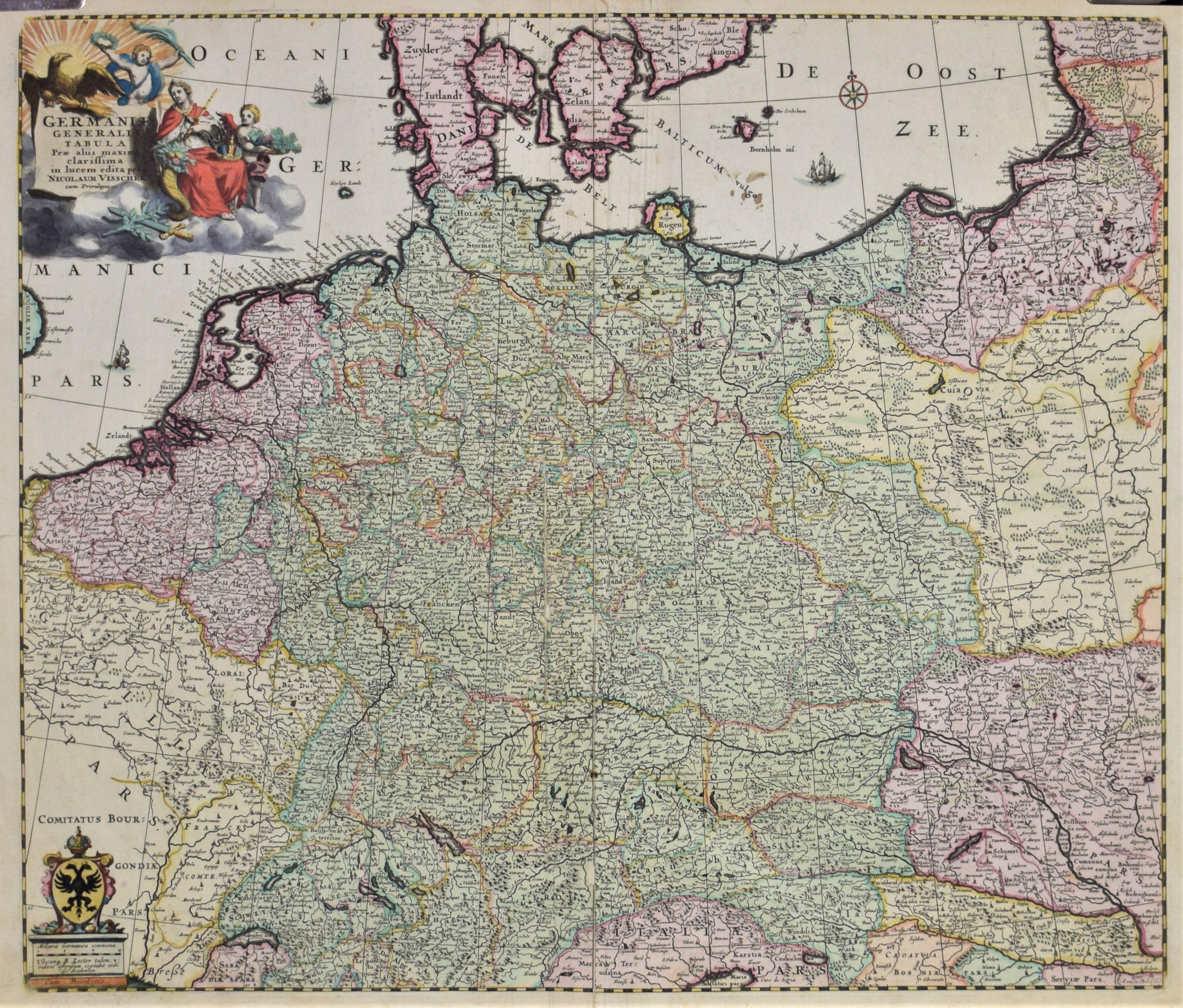
Visscher, N.: Germaniae Generalis
€800,00
Description
Nicolaus Visscher (1618-1709)
Germaniae Generalis Tabula Prae aliis maxime clarissima in lucem edita per Nicolaum Visscher cum Privilegio
17th century map of Germany by cartographer Nicolas Visscher.
Hand-coloured copperplate engraving. Large decorative cartouche.
Very informative map with lots of place names and administrative borders.
| Year of printing | ca. 1690 |
|---|---|
| Place of printing | Amsterdam |
| Technique | kuparipiirros / kopparstick / copper engraving |
| Illustrations | käsin värjätty / handkolorerad / hand-coloured |
| Dimensions | 47,5 x 57,5 cm |
| Condition | 3 |
| Condition explanations | (5) Mint, (4) Very good, (3) Good, (2) Fair, (1) Poor |
Additional information


