Shipping
Shipping is not included in the prices. The fee will be confirmed to the customer by a separate e-mail and depends on the parcel's size and destination.
Examples: Finland 5,90€; Sweden, Germany, Baltics 8,00€; Benelux, Denmark, Spain 12,00€; Non-EU 35,00€
terms & conditions
Before ordering we kindly ask you to read our terms and conditions.
availability
The selection of our online store is not available at the bookstore. If you wish to view some items, please contact us in advance.
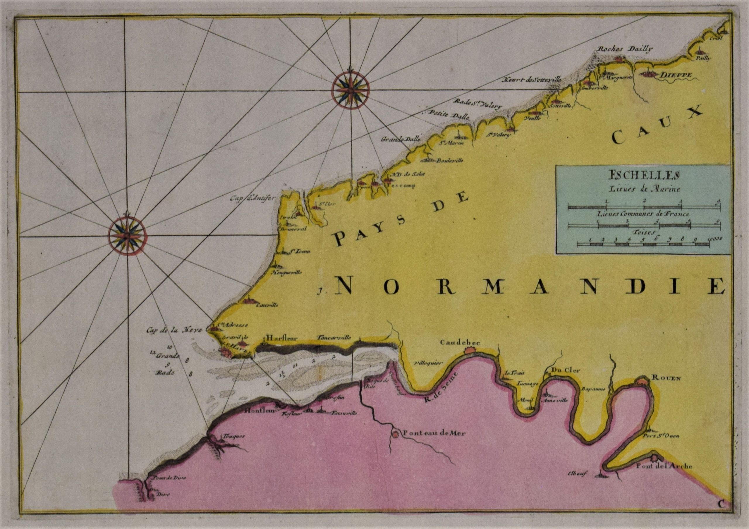
de Fer, Nicholas: Pays de Caux Normandie
€280,00
Description
Nicholas de Fer (1646-1720)
Pays de Caux Normandie
17th century map of the city of the Pays de Caux in Normandy, France.
Hand-coloured copperplate engraving. Two compass roses.
The cities of Dieppe, Le Havre, Caudebec and Rouen are shown on the map.
| Year of printing | ca. 1690 |
|---|---|
| Technique | kuparipiirros / kopparstick / copper engraving |
| Illustrations | käsinväritetty / handkolorerade / hand coloured |
| Dimensions | 22 x 33 cm |
| Condition | 3 |
| Condition explanations | (5) Mint, (4) Very good, (3) Good, (2) Fair, (1) Poor |
Additional information


