Shipping
Shipping is not included in the prices. The fee will be confirmed to the customer by a separate e-mail and depends on the parcel's size and destination.
Examples: Finland 5,90€; Sweden, Germany, Baltics 8,00€; Benelux, Denmark, Spain 12,00€; Non-EU 35,00€
terms & conditions
Before ordering we kindly ask you to read our terms and conditions.
availability
The selection of our online store is not available at the bookstore. If you wish to view some items, please contact us in advance.
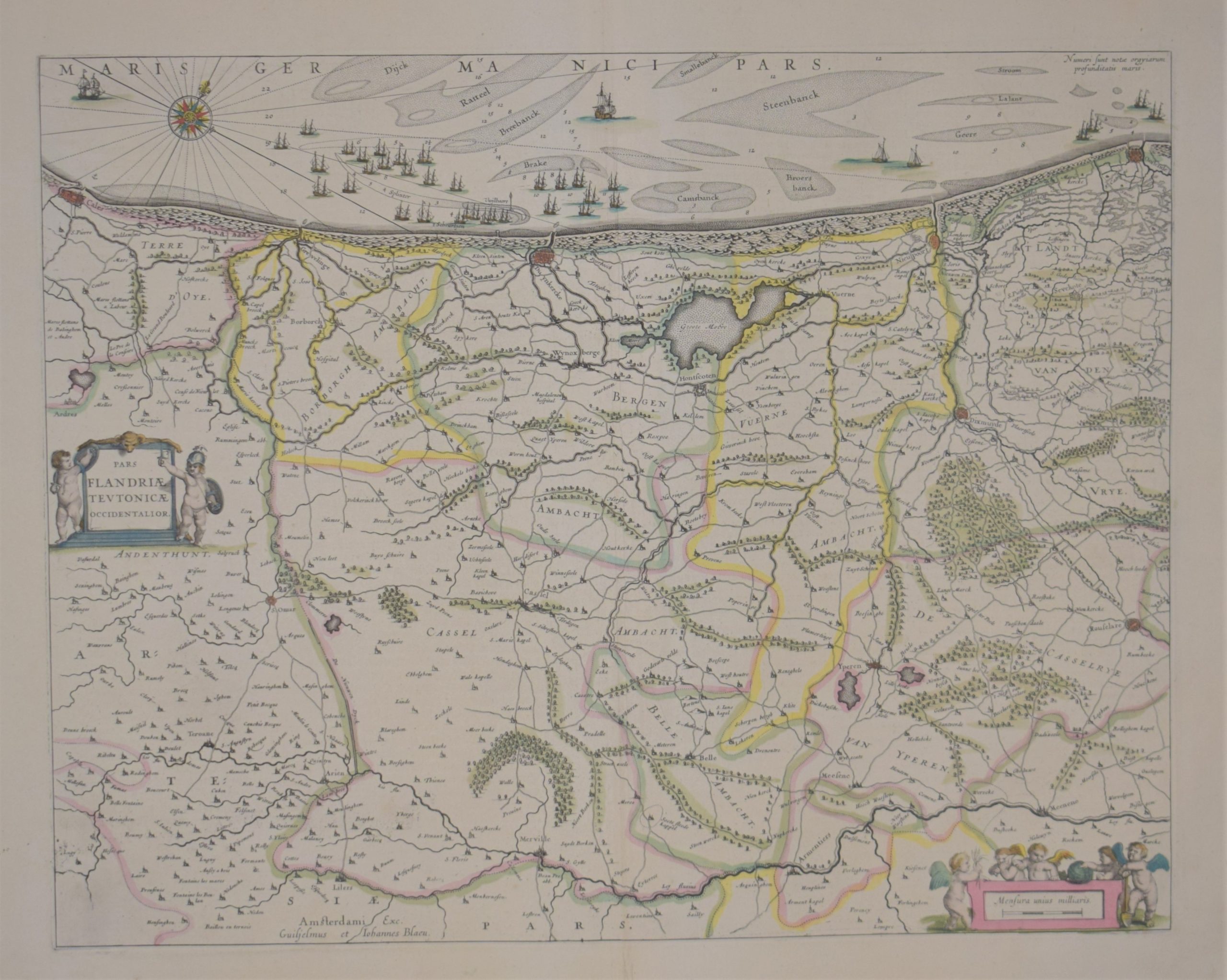
Blaeu, W. J.: Pars Flandriae Teutonicae Occidentalior
€400,00
Description
Willem Janszoon Blaeu (1571-1638)
Pars Flandriae Teutonicae Occidentalior
17th century map of northernmost France and the West Flanders in Belgium. Calais, Dunkirk, Nieuwpoort and Ostend are shown on the map.
Hand-coloured copperplate engraving. Two decorative cartouches. West oriented map.
Good condition with wide margins.
| Year of printing | 1638 |
|---|---|
| Place of printing | Amsterdam |
| Technique | kuparipiirros / kopparstick / copper engraving |
| Illustrations | käsin väritetty / handkolorerade / hand coloured |
| Dimensions | 39 x 50 cm |
| Condition | 3 |
| Condition explanations | (5) Mint, (4) Very good, (3) Good, (2) Fair, (1) Poor |
Additional information


