Shipping
Shipping is not included in the prices. The fee will be confirmed to the customer by a separate e-mail and depends on the parcel's size and destination.
Examples: Finland 5,90€; Sweden, Germany, Baltics 8,00€; Benelux, Denmark, Spain 12,00€; Non-EU 35,00€
terms & conditions
Before ordering we kindly ask you to read our terms and conditions.
availability
The selection of our online store is not available at the bookstore. If you wish to view some items, please contact us in advance.
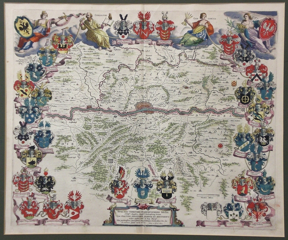
Blaeu, W.J.: Novam Hanc Territorii Francofurtensis Tabulum Nobilissis Magnificis
€900,00
Description
Willem Janzoon Blaeu (1571-1638)
“Novam hanc territorii Francofurtensis tabulam nobilissis magnificis amplissis prudentissimisq dominis…”
Beautiful map of Frankfurt and it’s surroundings by Dutch cartographer Willem Janzoon Blaeu.
17th century handcoloured copperplate engraving. Very good condition, bright colours.
| Year of printing | 1660 |
|---|---|
| Dimensions | 45,5 × 55 cm |
| Condition | 3 |
| Condition explanations | (5) Mint, (4) Very good, (3) Good, (2) Fair, (1) Poor |
| Other |
Additional information
YEAR OF PUBLICATION:
1660
Condition:
3
Condition explanations:
(5) Mint, (4) Very good, (3) Good, (2) Fair, (1) Poor
Dimensions:
45,5x55


