Shipping
Shipping is not included in the prices. The fee will be confirmed to the customer by a separate e-mail and depends on the parcel's size and destination.
Examples: Finland 5,90€; Sweden, Germany, Baltics 8,00€; Benelux, Denmark, Spain 12,00€; Non-EU 35,00€
terms & conditions
Before ordering we kindly ask you to read our terms and conditions.
availability
The selection of our online store is not available at the bookstore. If you wish to view some items, please contact us in advance.
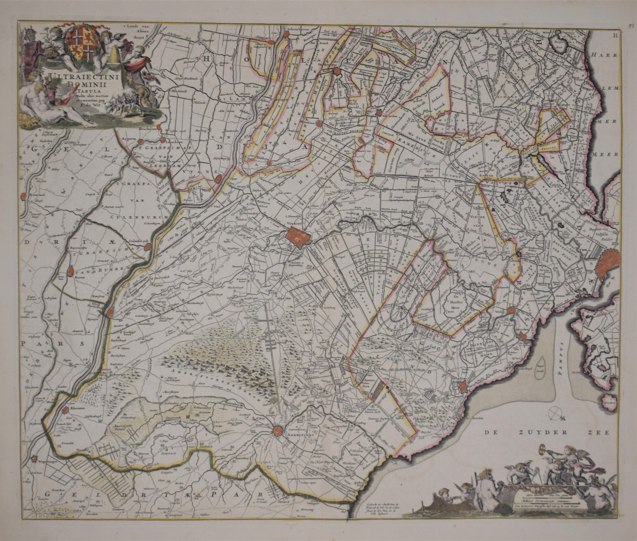
Wit, Frederick de: Ultraiectini Dominii Tabula
€750,00
Description
Ultraiectini Dominii Tabula
17th century map of Holland by Dutch cartographer de Wit.
Hand-coloured copperplate engraving. Good condition with nice colours.
The map shows the area with cities such as Amsterdam, Utrecht, Amersfoort.
| Year of printing | 1688 |
|---|---|
| Place of printing | Amsterdam |
| Technique | kuparipiirros / kopparstick / copper engraving |
| Illustrations | käsinväritetty / handkolorerade / hand coloured |
| Dimensions | 46 x 56 cm |
| Condition | 3 |
| Condition explanations | (5) Mint, (4) Very good, (3) Good, (2) Fair, (1) Poor |
| Other: | – |
Additional information


