WETTERSTEDT: Map of the Åland islands and Archipelago Sea (1789)
€1.300,00
1 in stock
Eric af Wetterstedt (1772-1822)
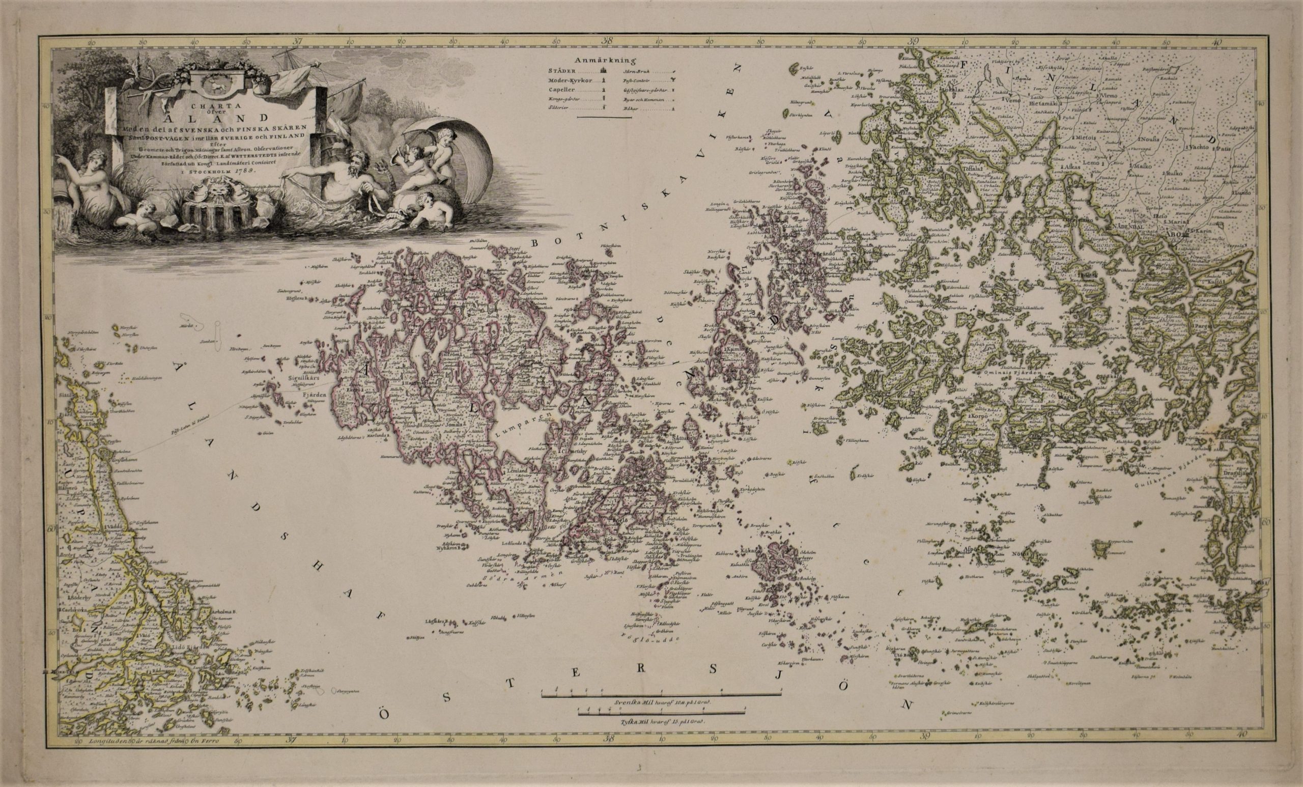
Old map of the Åland islands, featuring the Swedish and Finnish archipelago, and the Postal route between Sweden and Finland.
Charta öfver Åland med en del av svenska och finska skären samt post-vägen imellan Sverige och Finland
Ahvenanmaan kartta, jossa osa Ruotsin ja Suomen saaristoa, sekä vanha maiden välinen postireitti.
Rare 18th century map of the Åland islands, the Archipelago Sea and the edge of Sweden’s eastern archipelago, by Eric af Wetterstedt. Copper engraving with hand-coloured outlines. Published in 1789 in Stockholm.
In 1789, Finland was still a part of Sweden. The Åland islands played an important geopolitical role during the Swedish Empire. Besides being a strategic ”watchtower” for controlling the Baltic Sea, the islands provided a convenient route for travel between the two countries, thanks to the thousands of small islands surrounding Åland and the Archipelago Sea.
Wetterstedt’s map is both beautiful and informative. It features a large, decorative cartouche filled with mythological symbols related to the North. The postal route is engraved on the map, and numerous place names, towns, and even churches are marked on their correct locations.
- Condition: Bright colours and wide margins. Printed on thick paper.
- Dimensions: 45 x 74 cm
Suomeksi:
Eric af Wetterstedtin laatima harvinainen Ahvenanmaan kartta vuodelta 1789. Kuparipiirros, jossa käsinväritetyt rajat.
Karttakuvassa Saaristomeri, Ahvenanmaan saaristo sekä uloin osa Ruotsin itäisestä rannikosta. Karttaan on kaiverrettu vanha maiden välinen postireitti. Informatiivinen kartta, jossa suuri koristeellinen kartushi ja runsaasti paikannimiä. Kaupungit ja jopa kirkot on sijoitettu oikeille paikoilleen.
- Kunto: Hyvä kunto. Kirkkaat värit ja leveät marginaalit. Painettu paksulle lumppupaperille.
- Mitat: 45 x 74 cm
På svenska:
Eric af Wetterstedts karta över Åland, Skärgårdshavet och delar av den svenska skärgården. Kopparstick med handkolorerade gränser, utgiven i Stockholm år 1789.
Under 1700-talet var Åland av stor geopolitisk betydelse för det svenska riket. Förutom sin roll som ett strategiskt ”vaktstorn” i Östersjön, utgjorde ögruppen och Skärgårdshavet den viktigaste rutten mellan Sverige och Finland. Den historiska postvägen finns ritad på kartan.
Wetterstedts sällsyntä karta är både dekorativ och informativ. Kartan har en stor detaljerad kartusch, många ortnamn, även städer och kyrkor.
- Skick: I gott skick. Klara färger och breda marginaler.
- Mått: 45 x 74 cm


