Shipping
Shipping is not included in the prices. The fee will be confirmed to the customer by a separate e-mail and depends on the parcel's size and destination.
Examples: Finland 5,90€; Sweden, Germany, Baltics 8,00€; Benelux, Denmark, Spain 12,00€; Non-EU 35,00€
terms & conditions
Before ordering we kindly ask you to read our terms and conditions.
availability
The selection of our online store is not available at the bookstore. If you wish to view some items, please contact us in advance.
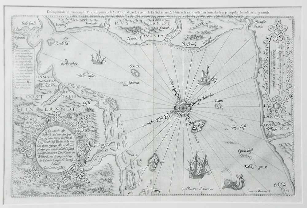
[16th century] Waghenaer, L.: Het wterste ofte Oosterste deel van de Oster Zee, Beslooten tegens Russlandt Lijfflandt, Oost Finlandt (1580)
€1.800,00
Description
Lucas Janszoon Waghenaer (ca. 1533 – 1606)
Het wterste ofte Oosterste deel van de Oster Zee, Beslooten tegens Russlandt Lijfflandt, Oost Finlandt, In weleken de twe opprste oste veerste laetplaetsen sijn van de geheele Oosterse navigatie, te weeten Der Narua en Wijburch, met de omstandlicheijt der Eijlanden, Clippen, eñ Sweetse Schaerē. Doer Lucas Iansz. Wag.
Amsterdam, ca. 1580. Lucas Waghenaer’s sea chart of the Baltic Sea and Gulf of Finland. Very decorative map with sea monsters, vessels and a large compass rose. East-oriented map.
Uncoloured copper engraving. Good condition. Framed in passepartout.
Additional information
YEAR OF PUBLICATION:
ca.1580
PLACE OF PUBLICATION:
Amsterdam
Condition:
3, good condition
Dimensions:
34x51
Other:
pahvikehys / passepartout


