Shipping
Shipping is not included in the prices. The fee will be confirmed to the customer by a separate e-mail and depends on the parcel's size and destination.
Examples: Finland 5,90€; Sweden, Germany, Baltics 8,00€; Benelux, Denmark, Spain 12,00€; Non-EU 35,00€
terms & conditions
Before ordering we kindly ask you to read our terms and conditions.
availability
The selection of our online store is not available at the bookstore. If you wish to view some items, please contact us in advance.
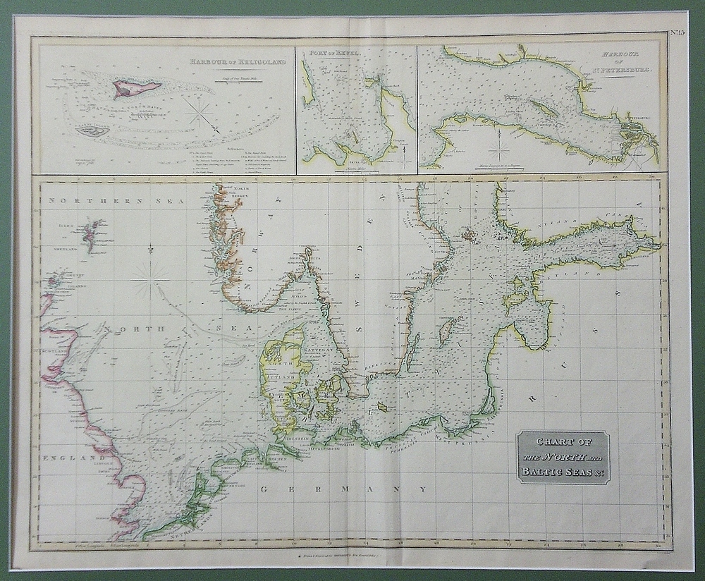
[19th century] Thompson: Chart of the North and Baltic Seas (1812)
€250,00
Description
John Thompson (1777-1840)
Chart of the North and Baltic Seas
19th century map of the North Sea and the Baltic Sea. Three inset maps: Heligoland, Revel (Tallinn) and Saint Petersburg.
Good condition. Framed in passepartout.
Additional information
Publisher:
George Philip & Son
YEAR OF PUBLICATION:
1812
PLACE OF PUBLICATION:
Liverpool
Condition:
3, good condition
Dimensions:
48,5x60
Other:
pahvikehys / passepartout


