Shipping
Shipping is not included in the prices. The fee will be confirmed to the customer by a separate e-mail and depends on the parcel's size and destination.
Examples: Finland 5,90€; Sweden, Germany, Baltics 8,00€; Benelux, Denmark, Spain 12,00€; Non-EU 35,00€
terms & conditions
Before ordering we kindly ask you to read our terms and conditions.
availability
The selection of our online store is not available at the bookstore. If you wish to view some items, please contact us in advance.
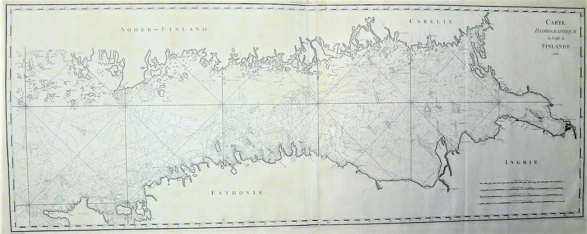
[18th century] Tardieu, P.F.: Carte hydrographique du Golfe de Finlande (1785)
€1.200,00
Description
Pierre François Tardieu (1711-1771)
Carte hydrographique du Golfe de Finlande
Ranskalaisen Tardieun laatima suurikokoinen merikortti Suomenlahden alueelta. Kartassa kuvattuna alue Hangon ja Pietarin välillä. Mustavalkoinen kuparikaiverrus, joka koostuu kahdesta yhteenliitetystä karttalehdestä. Hyvä kunto.
Large sea chart of the Gulf of Finland by French engraver Pierre Francois Tardieu. The map is depitcting the area from Hanko to St.Petersburg. Uncoloured copperplate engraving. Two sheets joined together. Good condition.
Additional information
Publisher:
Dépôt de la Marine
YEAR OF PUBLICATION:
1785
PLACE OF PUBLICATION:
Paris
Condition:
3, hyvä kunto - good condition
Dimensions:
47x124,5
Technique:
kuparipiirros / kopparstick / copper engraving


