Shipping
Shipping is not included in the prices. The fee will be confirmed to the customer by a separate e-mail and depends on the parcel's size and destination.
Examples: Finland 5,90€; Sweden, Germany, Baltics 8,00€; Benelux, Denmark, Spain 12,00€; Non-EU 35,00€
terms & conditions
Before ordering we kindly ask you to read our terms and conditions.
availability
The selection of our online store is not available at the bookstore. If you wish to view some items, please contact us in advance.
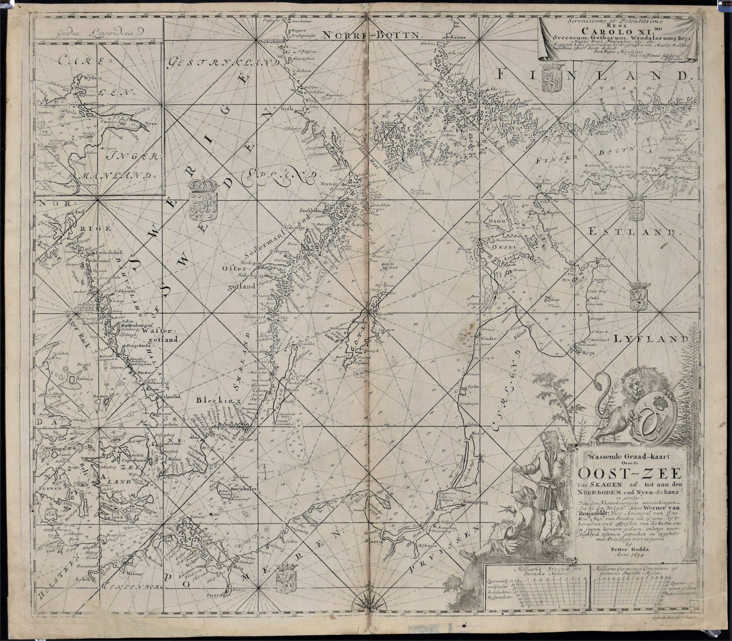
Gedda, Petter: Wassende Graad-kaart over de Oost-Zee van Skagen (1694)
€2.800,00
Description
Petter Gedda (1661-1697)
Wassende Graad-kaart Over de Oost-Zee Van Skagen aff. tot aan den Nordbodem end’Nyen-Schanz : in gevolge van den naeuwkeurigste anmerkingen … met privilegie voor 10. jaeren / bÿ Petter Gedda, anno 1694
Petter Gedda’s original sea chart of Baltic Sea from 1694. Dedicated to Charles XI (Karl XI 1655-1697). Copper engraving.
The map depicts the area from Skagerrak to the Eastern part of Gulf of Finland. Nyenschantz depicted in inset map in the upper left corner. Large decorative cartouche with a lion. Five coat-of-arms, compass rose and loxodromes.
The map is restored. Margins and centrefold reinforced from verso. Browning in centrefold on the image side. Short upper margin.
Additional information
YEAR OF PUBLICATION:
1694
Condition:
The map is restored. Some browning. Short upper margin.
Dimensions:
53 x 61 cm
Technique:
Copper engraving


