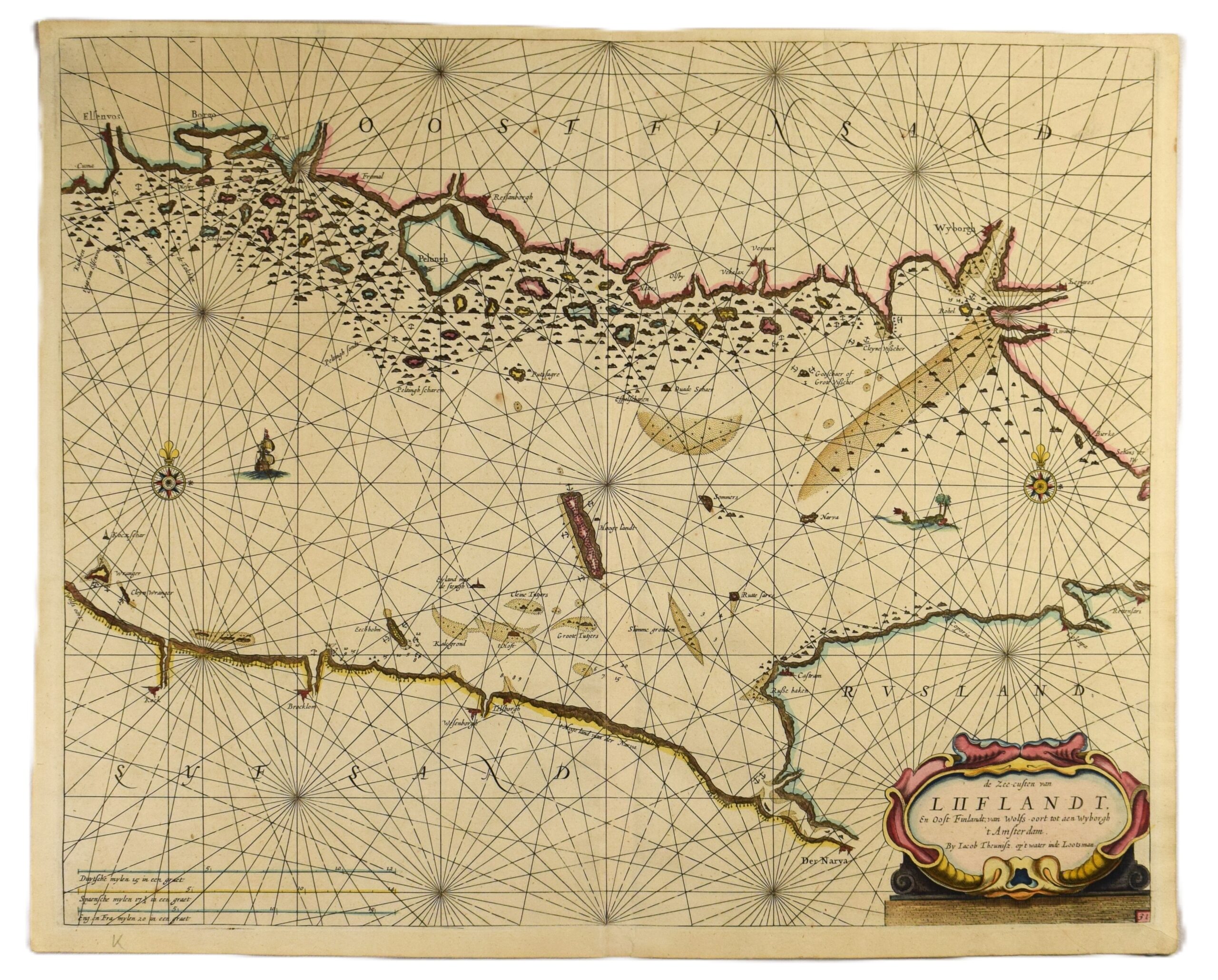
LOOTSMAN: Sea chart of the Gulf of Finland (1663)
€1.200,00
1 in stock
Jacob Theunisz (Lootsman brothers)
De Zee-custen van Liiflandt, En Oost Finlandt, van Wolfsoort tot aen Wyborgh ‘t Amsterdam.
Sea chart of the eastern Gulf of Finland | Suomenlahden itäosan merikortti | Sjökort över östra Finska viken
17th century Dutch sea chart of the Gulf of Finland by Jacob Theunisz, one of the renowned Lootsman brothers. This copperplate engraving features fine hand-coloured outlines and decorative elements. It was published in Amsterdam in 1663, as a part of the Zee-Spiegel (Sea Mirror), one of the most popular maritime atlases of the Dutch Golden Age.
The map depicts the eastern part of the Gulf of Finland, extending from Helsinki (Elsenvos) to Vyborg (Wybourgh) on the northern shore, and from Prangli island (Wrangler) to Narva on the Estonian coast. The coastline is detailed with coastal cities and landmarks, islands and soundings. Classical Dutch maritime decorations are featured on the map, including an ornamental title cartouche in the lower right corner and a scale bar on the lower left. Colourful compass roses, a sea vessel, a net of loxodromes and a sea monster appearing to swim eastward. The map is in good condition with vibrant colours.
- Condition: Good.
- Dimensions: 44,5 x 55,5 cm
Suomeksi:
1600-luvun hollantilainen Suomenlahden itäosan merikortti. Käsinväritetty kuparipiirros, painettu Amsterdamissa vuonna 1663. Karttakuvassa alue Helsingin ja Viipurin välillä, sekä Viron puolella alue Tallinnan edustan ja Narvan välillä. Rannikkoalueille merkitty tärkeitä kaupunkeja, linnoituksia sekä saaria. Kartta on koristeltu tyypillisin hollantilaisin elementein: elegantti kartushi, kompassiruusuja, loksodromeja, purjelaiva sekä itää kohti uiva merihirviö. Hyväkuntoinen kartta, jossa kirkas väritys.
- Kunto: Hyvä kunto.
- Mitat: 44,5 x 55,5 cm
På svenska:
Ett holländskt sjökort över östra Finska viken, tryckt i Amsterdam 1663. Handkolorerat kopparstick. Kartan visar den östra delen av Finska viken, från Helsingfors till Viborg i norr, samt från Prangli till Narva i söder. Rikt detaljerad i klassisk holländsk stil med en dekorativ titelkartusch, vindrosor, ett segelfartyg och ett sjöodjur. Kartbilden innehåller djupsiffror, ortnamn och navigationsmärken. Gott skick med fina färger.
- Skick: Gott skick.
- Mått: 44,5 x 55,5 cm
***
The Lootsman house was a renowned printing and publishing firm in Amsterdam, founded by Anthonie Theunis Jacobz (1606/7 – 1650). His sons, Jacob and Casparus, continued the family business and became known as the Lootsman brothers. Lootsman house was an influential Amsterdam publisher that specialized in maritime atlases and navigational works during the Dutch Golden Age.


