Shipping
Shipping is not included in the prices. The fee will be confirmed to the customer by a separate e-mail and depends on the parcel's size and destination.
Examples: Finland 5,90€; Sweden, Germany, Baltics 8,00€; Benelux, Denmark, Spain 12,00€; Non-EU 35,00€
terms & conditions
Before ordering we kindly ask you to read our terms and conditions.
availability
The selection of our online store is not available at the bookstore. If you wish to view some items, please contact us in advance.
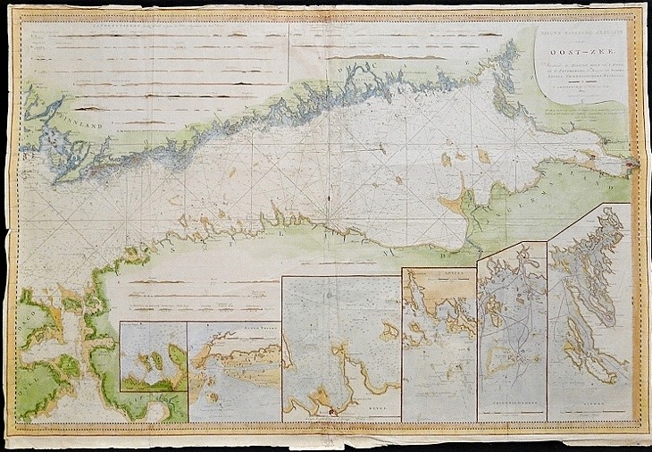
[18th century] Keulen: Nieuwe wassende Zeekart van de Oost-Zee (1805)
€1.800,00
Description
Gerard Hulst van Keulen (1733-1801)
Nieuwe wassende Zeekart van de Oost-Zee. Bevattende de Finsche Golf van I. Dago, tet St. Petersburg de Karens van Wiborg, Lovisa, Friedrichshamn, Revel…
Sea chart of the Gulf of Finland by Dutch cartographer Gerard Hulst van Keulen published at the very beginning of the 19th century. The chart includes six smaller inset maps. Hand-coloured copperplate engraving. Dimensions 63×93 cm.
Condition of the map is somewhat worn and wrinkled.
Additional information
YEAR OF PUBLICATION:
1805
Condition:
2
Condition explanations:
(5) Mint, (4) Very good, (3) Good, (2) Fair, (1) Poor
Dimensions:
63x93
Other:
wrinkled, ryppyinen, skrynklig


