Shipping
Shipping is not included in the prices. The fee will be confirmed to the customer by a separate e-mail and depends on the parcel's size and destination.
Examples: Finland 5,90€; Sweden, Germany, Baltics 8,00€; Benelux, Denmark, Spain 12,00€; Non-EU 35,00€
terms & conditions
Before ordering we kindly ask you to read our terms and conditions.
availability
The selection of our online store is not available at the bookstore. If you wish to view some items, please contact us in advance.
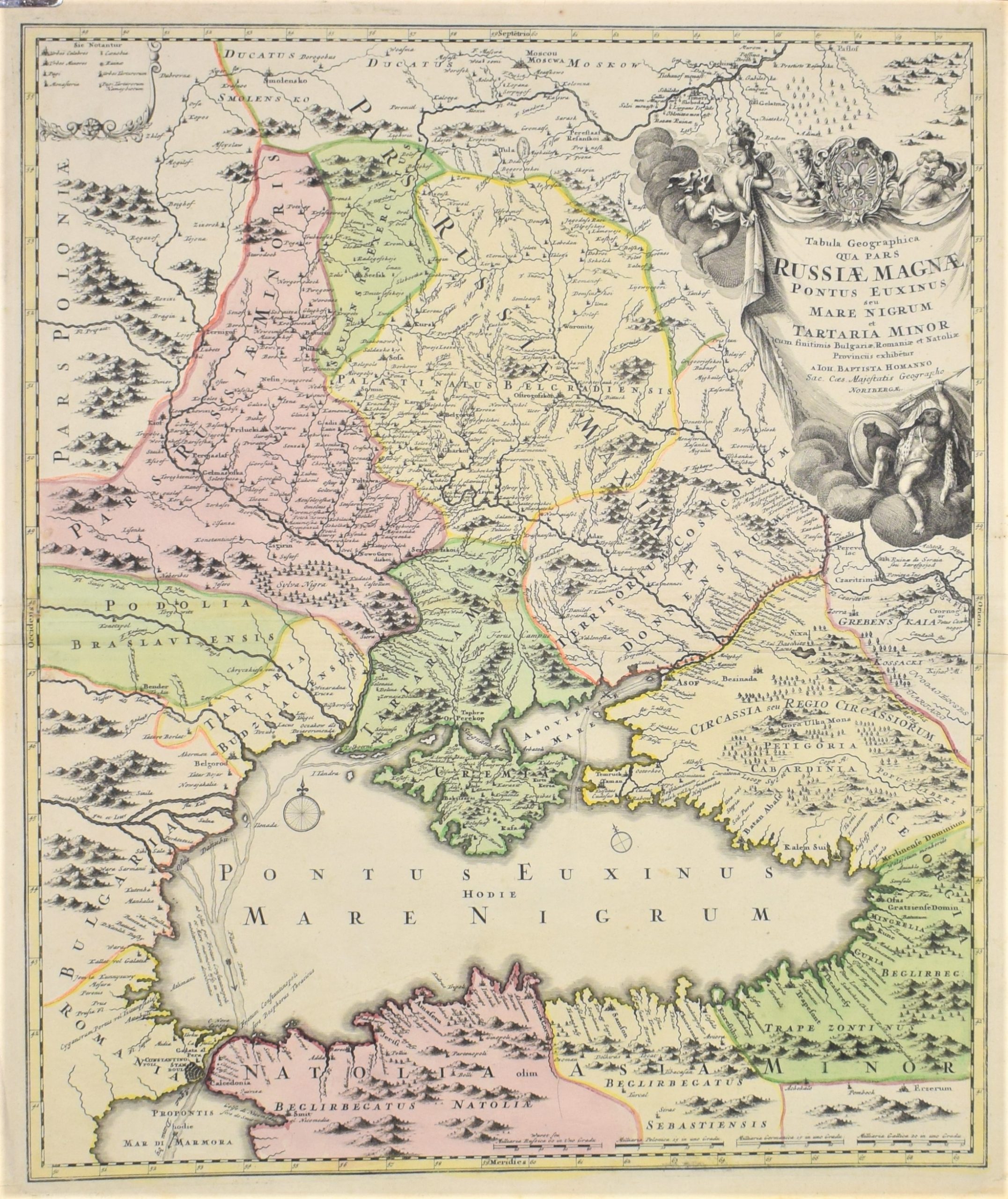
Homann, Joh. Bapt.: Tabula Geographica qua pars Russiae Magnae
€300,00
Description
Johann Baptista Homann (1664-1724)
Tabula Geographica qua pars Russiae Magnae Pontus Euxinus seu Mare Nigrum et Tartaria Minor.
18th century map of the regions around the Black Sea with Moscow in the north, the Crimea in the middle and Constantinople (Istanbul) in the south.
Hand-coloured copper engarving with a large decorative cartouche full of interesting symbols.
Detailed map with place names, waterways and political borders. Nice graphical illustrations.
| Year of printing | 1718 |
|---|---|
| Technique | kuparipiirros / kopparstick / copper engraving |
| Colour | käsin väritetty / handkolorerad / hand coloured |
| Dimensions | 58 x 48 cm |
| Condition | 3 |
| Condition explanations | (5) Mint, (4) Very good, (3) Good, (2) Fair, (1) Poor |
Additional information


