Shipping
Shipping is not included in the shop prices. The final price including shipping will be confirmed to the customer by a separate e-mail and will depend on the parcel's size and destination. We try our best to find the most economical and safe shipping way possible.
Examples of the most common shipping fees: Finland 5,90€; Sweden, Germany, Baltics 8,00€; Benelux, Denmark, Spain, Poland 12,00€; Non-EU 35,00€
terms & conditions
Before ordering we kindly ask you to read our terms and conditions.
availability
Please notice that the book selection of our online store is not available at the bookstore. If you wish to view some items, please make an order or contact us in advance.
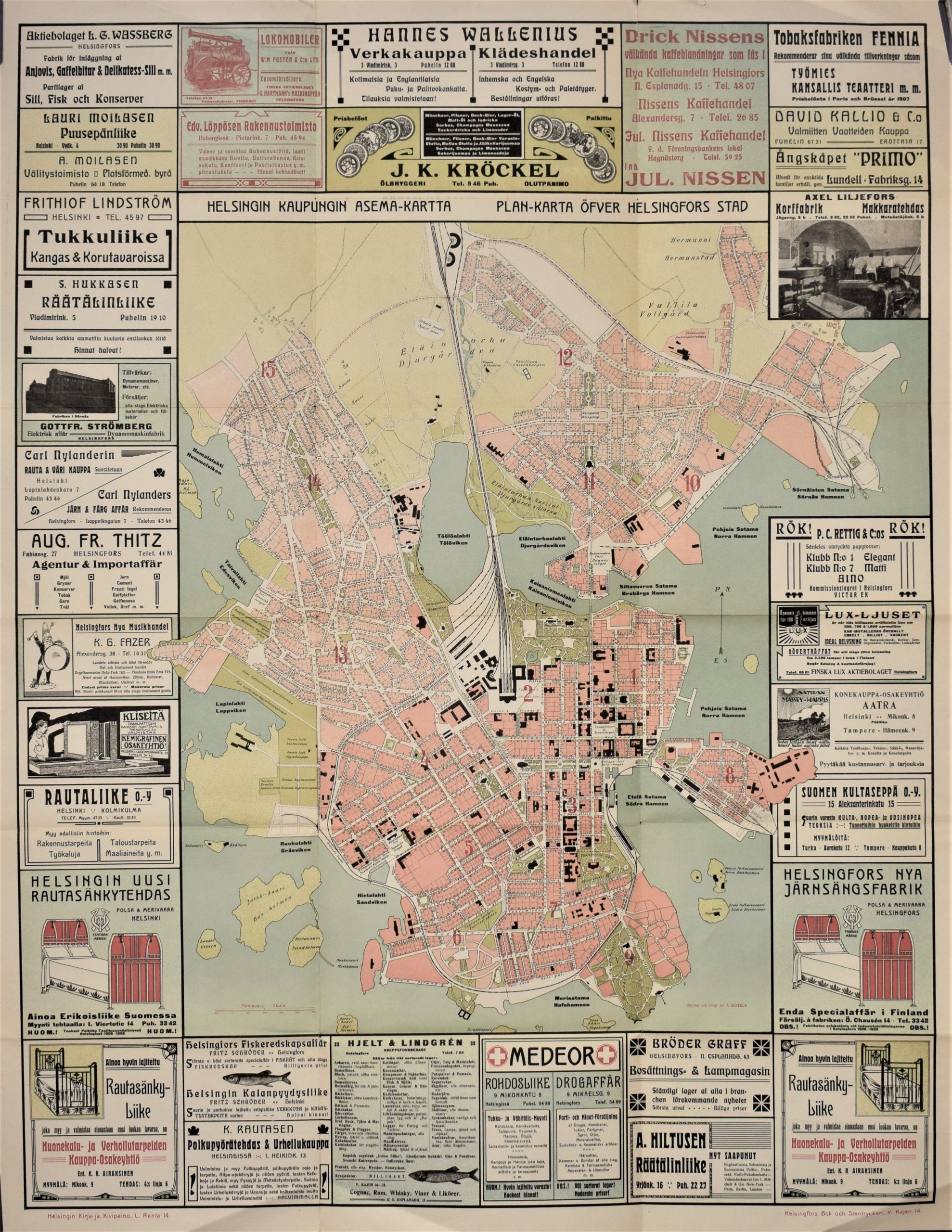
Helsingin kaupungin asema-kartta – Plan-karta öfver Helsingfors stad (1905-1910)
€900,00
Description
Helsingin kaupungin asema-kartta – Plan-karta öfver Helsingfors stad
Helsingin kartta 1900-luvun ensimmäiseltä vuosikymmeneltä. Värillinen kivipainokuva. Mitat 95 x 74 cm. Hyvä kunto.
Kaupunginosat on numeroitu kartalle. Karttakuvaa kehystää vanhat mainosilmoitukset, mm. Nissenin kahvila, Fazerin musiikkikauppa.
***
Karta över Helsingfors stad från början av 1900-talet. Litografiskt tryck med färg. Mått 95 x 74 cm. Bra skick.
Stadsdelen är numrerade. Intressant karta med mycket information. Reklamerna omger kartan.
Additional information


