Shipping
Shipping is not included in the shop prices. The final price including shipping will be confirmed to the customer by a separate e-mail and will depend on the parcel's size and destination. We try our best to find the most economical and safe shipping way possible.
Examples of the most common shipping fees: Finland 5,90€; Sweden, Germany, Baltics 8,00€; Benelux, Denmark, Spain, Poland 12,00€; Non-EU 35,00€
terms & conditions
Before ordering we kindly ask you to read our terms and conditions.
availability
Please notice that the book selection of our online store is not available at the bookstore. If you wish to view some items, please make an order or contact us in advance.
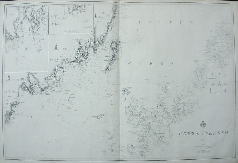
[19th century] Klint, Gustaf af: Norra Qvarken (1861)
€300,00
Description
Gustaf af Klint (1771-1840)
Norra Qvarken
Swedish sea chart of Kvarken in the Gulf of Bothnia from 19th century. The map is showing the both sides of the Bothnian Bay: the Swedish and the Finnish coast. Uncoloured engraving. Dimensions 67 × 99 cm. Condition of the map is good. Right margin is restored.
The map is made by Swedish cartographer and navy officer Gustaf af Klint. He produced “Sveriges sjöatlas” (the Swedish Sea atlas) with sea charts of the Swedish coast and seas close-by. Klint’s maps are very accurate and detailed.
Additional information
YEAR OF PUBLICATION:
1861
Condition:
3
Condition explanations:
(5) Mint, (4) Very good, (3) Good, (2) Fair, (1) Poor
Dimensions:
67x99
Other:
oikea reuna kunnostettu,högra sidan restaurerad


