Shipping
Shipping is not included in the shop prices. The final price including shipping will be confirmed to the customer by a separate e-mail and will depend on the parcel's size and destination. We try our best to find the most economical and safe shipping way possible.
Examples of the most common shipping fees: Finland 5,90€; Sweden, Germany, Baltics 8,00€; Benelux, Denmark, Spain, Poland 12,00€; Non-EU 35,00€
terms & conditions
Before ordering we kindly ask you to read our terms and conditions.
availability
Please notice that the book selection of our online store is not available at the bookstore. If you wish to view some items, please make an order or contact us in advance.
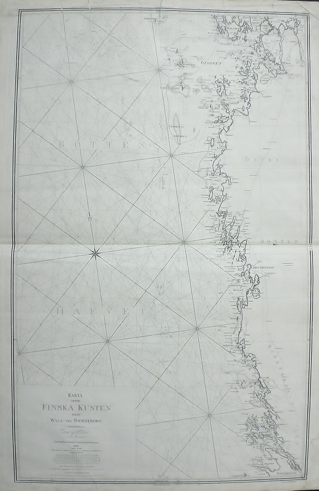
[19th century] Klint, Gustaf: Karta öfver Finska kusten ifrån Wasa till Björneborg (1849)
€350,00
Description
Gustaf af Klint (1771-1840)
Karta öfver Finska kusten ifrån Wasa till Björneborg
Swedish sea chart of the Gulf of Bothnia showing the region between Vaasa and Pori. Uncoloured engraving. Dimensions 100 × 62 cm. Overall condition of the map is somewhat worn and there’s a tear in the middle folding and some small stains.
The map is made by Swedish cartographer and navy officer Gustaf af Klint. He produced “Sveriges sjöatlas” (the Swedish Sea atlas) with sea charts of the Swedish coast and seas close-by. Klint’s maps are very accurate and detailed.
Additional information
YEAR OF PUBLICATION:
1849
Condition:
2
Condition explanations:
(5) Mint, (4) Very good, (3) Good, (2) Fair, (1) Poor
Dimensions:
100x62
Other:
laikkuja ja repeämiä (lievä keskellä), fläckar samt revor ( en smärre i mitten)


