Shipping
Shipping is not included in the prices. The fee will be confirmed to the customer by a separate e-mail and depends on the parcel's size and destination.
Examples: Finland 5,90€; Sweden, Germany, Baltics 8,00€; Benelux, Denmark, Spain 12,00€; Non-EU 35,00€
terms & conditions
Before ordering we kindly ask you to read our terms and conditions.
availability
The selection of our online store is not available at the bookstore. If you wish to view some items, please contact us in advance.
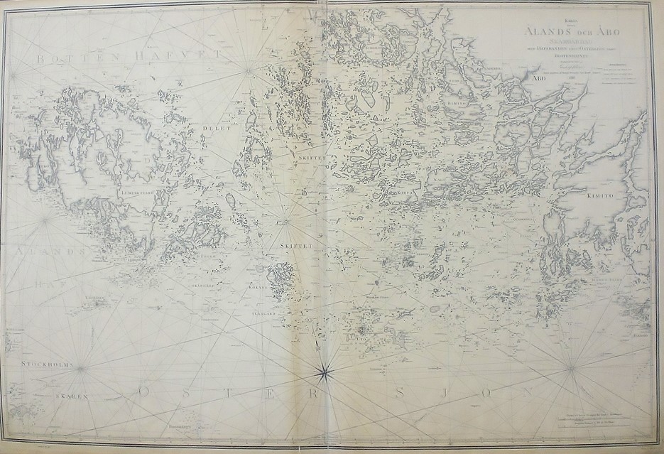
[19th century] Klint, Gustaf af: Karta öfver Ålands och Åbo skärgårdar (1849)
€1.450,00
Description
Gustaf af Klint (1771-1840)
Karta öfver Ålands och Åbo skärgårdar med hafsbanden emot Östersjön samt Bottenhafvet
Gustaf af Klint’s sea chart of Åland and Turku archipelago in the Baltic Sea. Uncoloured engraving. Good overall condition. Some toning and a small tear in the lower margin.
Gustaf af Klint was a Swedish cartographer and navy officer. He produced “Sveriges sjöatlas” (the Swedish Sea atlas) with sea charts of the Swedish coast and seas close-by. Klint’s maps are very accurate and detailed.
Additional information
YEAR OF PUBLICATION:
1849
Condition:
3
Condition explanations:
(5) Mint, (4) Very good, (3) Good, (2) Fair, (1) Poor
Other:
bruntonig, reva i nedre marginalen, ruskehtava, pieni repeämä alamarginaalissa


