Shipping
Shipping is not included in the prices. The fee will be confirmed to the customer by a separate e-mail and depends on the parcel's size and destination.
Examples: Finland 5,90€; Sweden, Germany, Baltics 8,00€; Benelux, Denmark, Spain 12,00€; Non-EU 35,00€
terms & conditions
Before ordering we kindly ask you to read our terms and conditions.
availability
The selection of our online store is not available at the bookstore. If you wish to view some items, please contact us in advance.
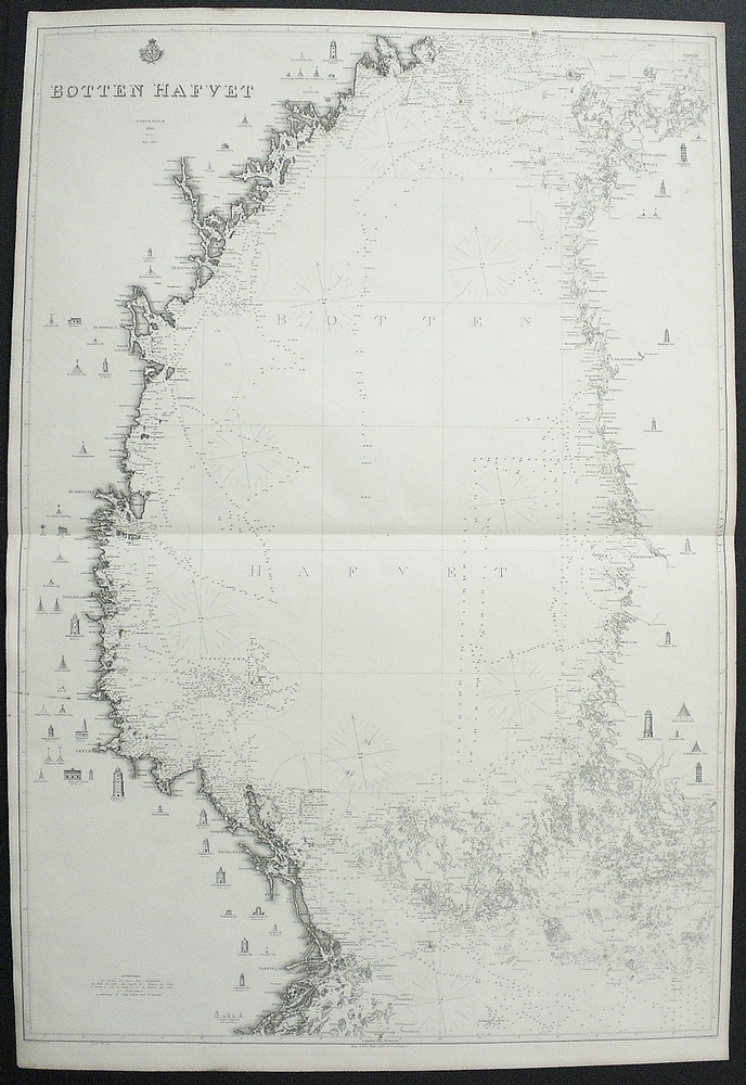
[19th century] Klint, Gustaf af: Bottenhafvet (1864)
€450,00
Description
Gustaf af Klint (1771-1840)
Bottenhafvet
Swedish sea chart of the Bothnian Sea between Sweden and Finland. Uncoloured engraving. Dimensions 99 x 68 cm. Good condition.
The map is made by Swedish cartographer and navy officer Gustaf af Klint. He produced “Sveriges sjöatlas” (the Swedish Sea atlas) with sea charts of the Swedish coast and seas close-by. Klint’s maps are very accurate and detailed.
Additional information
YEAR OF PUBLICATION:
1864
Condition:
3, good condition
Dimensions:
99x68


