Shipping
Shipping is not included in the prices. The fee will be confirmed to the customer by a separate e-mail and depends on the parcel's size and destination.
Examples: Finland 5,90€; Sweden, Germany, Baltics 8,00€; Benelux, Denmark, Spain 12,00€; Non-EU 35,00€
terms & conditions
Before ordering we kindly ask you to read our terms and conditions.
availability
The selection of our online store is not available at the bookstore. If you wish to view some items, please contact us in advance.
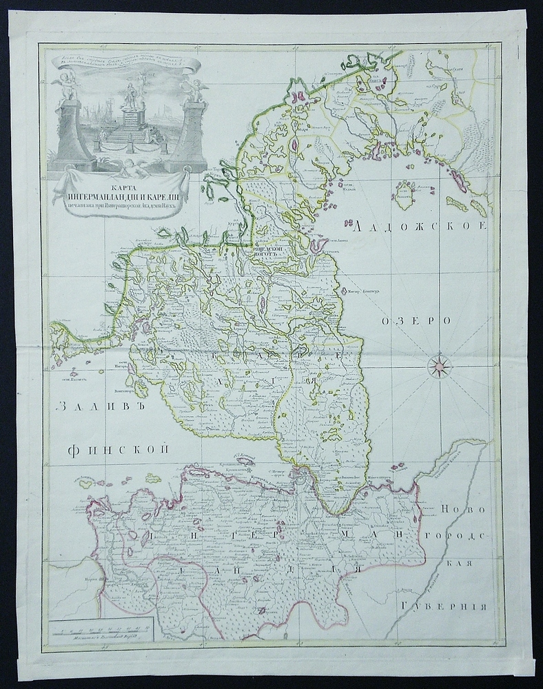
Grimmel; De L’Isle: Карта Ингерманланіи и Кареліи / Karta Ingermanlanii i Karelii
€820,00
Description
Grimmel, Johan Elias (1703-1759); De L’Isle, Joseph Nicolas (1688-1768)
Карта Ингерманланіи и Кареліи печатана при Императорской Академіи Наукъ / Karta Ingermanlanii i Karelii petšatana pri Imperatorskoj Akademii Nauk.
18th century engraved map showing Ingria and Karelia.
| Publisher | St.Petersburg: Russian Academy of ScienceИмператорской Академий Наук |
|---|---|
| Year of printing | ca. 1740 |
| Dimensions | 62 x 49 cm |
| Condition | 3 |
| Condition explanations | (5) Mint, (4) Very good, (3) Good, (2) Fair, (1) Poor |
Additional information
YEAR OF PUBLICATION:
1700-lukua/tal
Condition:
3
Condition explanations:
(5) Mint, (4) Very good, (3) Good, (2) Fair, (1) Poor
Dimensions:
60,5 x 46 cm


