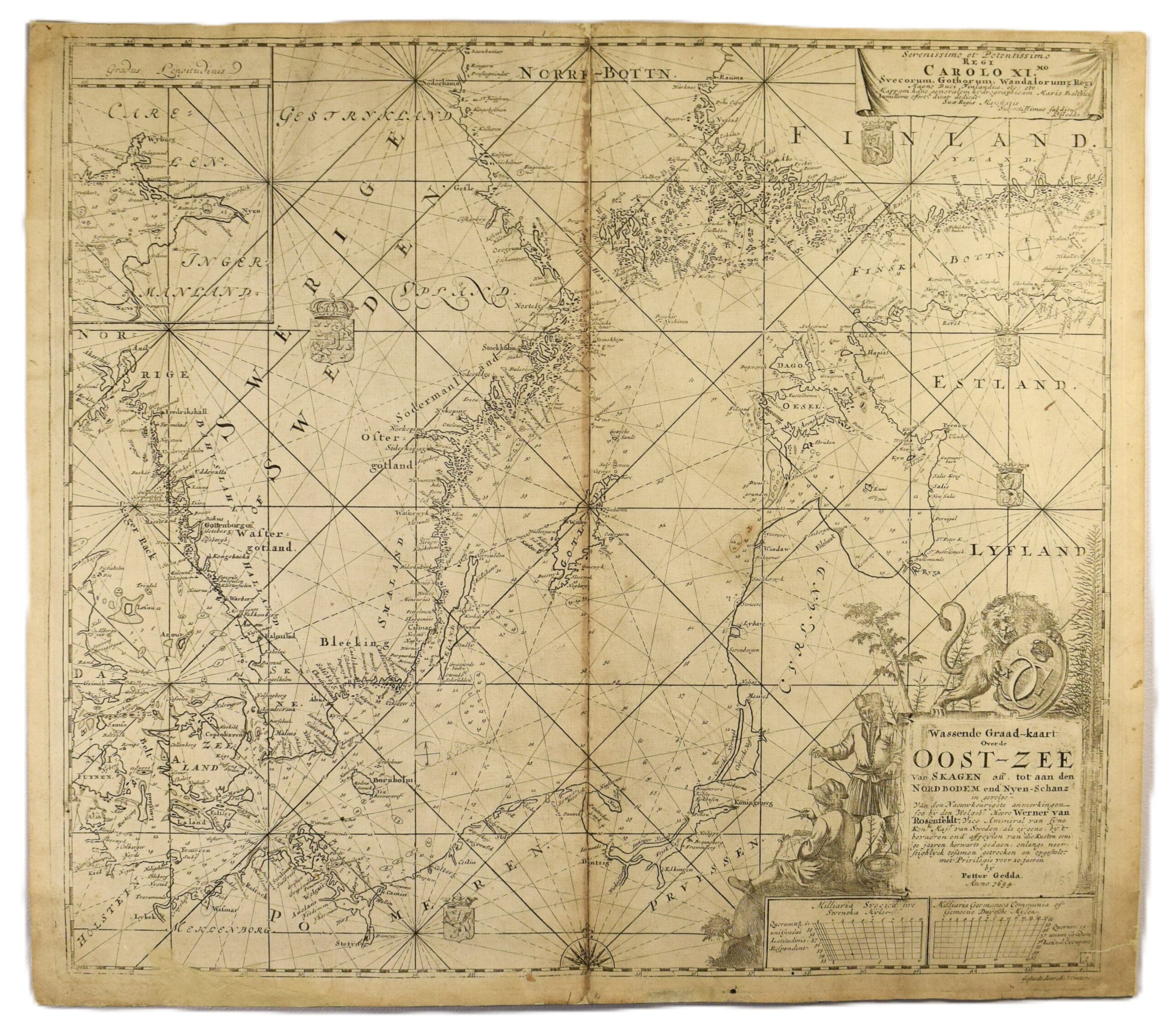
GEDDA: Sea chart of the Baltic Sea (1695)
€2.800,00
1 in stock
Petter Gedda (1661 – 1697)
Wassende Graad-kaart Over de Oost-Zee van Skagen aff. Tot aan den Nordbotten end Nyen-Schanz
Sea chart of the Baltic Sea | Itämeren merikortti | Sjökort över Östersjön
Petter Gedda’s highly detailed sea chart of the Baltic Sea, published in Amsterdam in 1695 as part of the Dutch edition of Gedda’s sea atlas. Uncoloured copperplate engraving.
Gedda’s work was based on his and Werner von Rosenfeldt’s extensive surveys along the coasts of the Baltic Sea. After careful work, Gedda produced a series of maps that were superior to all previous maps of the region. Gedda’s map are full of practical information, including place names, islands, and soundings, ensuring his sea atlas became the definitive basic work for the Baltic area for decades.
The map extends from Norwegian border and Skagen in the west to the Nyenchantz fortress at the eastern tip of the Gulf of Finland. The Pomeranian and Baltic coastlines detailed along the way. A separate inset map depicts the surroundings of Nyenchantz (modern-day St. Petersburg). To the north, the Åland islands and the Gulf of Bothnia are shown with great detail: place names are recorded as far as Rauma on the Finnish side and Söderhamn on the Swedish side. Gedda gave the coasts of Finland an accurate shape.
In addition to the new accurate information on the Baltic Sea, the map is also beautifully detailed: an impressive title cartouche showing the Swedish lion, a formal dedication to the King Charles XI, five coats of arms, a compass rose and a net of loxodromes.
The map is in good overall condition with some old restorations. There is a small area of paper loss in the lower left margin, which has been stabilized. The sheet has been reinforced on the verso, with particular attention given to stregthening the centrefold and the margins. Some browning on the centrefold.
- Condition: Reinforced on the verso. Small area of paper loss. Browning on the centrefold.
- Dimensions: 53 x 61 cm
Suomeksi:
Petter Geddan yksityiskohtainen merikortti Itämerestä, julkaistu Amsterdamissa vuonna 1695. Mustavalkoinen kuparipiirros. Karttakuvassa alue Norjan rajalta Nevanlinnalle, joka tarkemmin kuvattu pienessä kartakkeessa. Pohjanlahti tarkasti kuvattu Raumaan saakka. Ahvenanmaa ja Suomen rannikko alkavat löytää oikeat muotonsa. Karttaa on restauroitu ja vahvistettu kääntöpuolelta. Pieni pala vasemmasta alamarginaalista korjattu. Keskitaitos hieman tummunut.
- Kunto: Restauroitu ja vahvistettu. Keskitaitoksessa tummentumaa.
- Mitat: 53 x 61 cm
På svenska:
Petter Geddas detaljerade sjökort över Östersjön från 1695, publicerat i Amsterdam. Okolorerat kopparstick. Kartbilden täcker området från Skagen till Finska viken, inklusive detaljerade skildringar av Åland, Bottniska viken fram till Raumo och Söderhamn och en infälld karta över Nyenskans. Dekorativ titelkartusch med Svenska lejonet. En dedikation till Karl XI. Gott helhetsintryck med äldre lagningar och förstärkningar längs mittvecket och kanterna. Mittvecket något gulnat.
- Skick: Äldre lagningar och förstärkningar. Mittvecket ngt gulnat.
- Mått: 53 x 61 cm
***
Petter Gedda (1661 – 1697) was a Swedish surveyor and cartographer. He worked first as an assistant to Werner von Rosenfeldt on surveys of the Baltic Sea, and was then appointed Director of Pilotage in 1696. Between 1681 and 1694 Gedda surveyed all the coasts around the Baltic Sea, resulting in the first Swedish sea-atlas. Gedda’s charts were superior to Dutch charts, including much more details. His atlas was published in 1695 simultaneously in Swedish, Dutch and English.
(References: Koeman, Tooley’s)


