Shipping
Shipping is not included in the shop prices. The final price including shipping will be confirmed to the customer by a separate e-mail and will depend on the parcel's size and destination. We try our best to find the most economical and safe shipping way possible.
Examples of the most common shipping fees: Finland 5,90€; Sweden, Germany, Baltics 8,00€; Benelux, Denmark, Spain, Poland 12,00€; Non-EU 35,00€
terms & conditions
Before ordering we kindly ask you to read our terms and conditions.
availability
Please notice that the book selection of our online store is not available at the bookstore. If you wish to view some items, please make an order or contact us in advance.
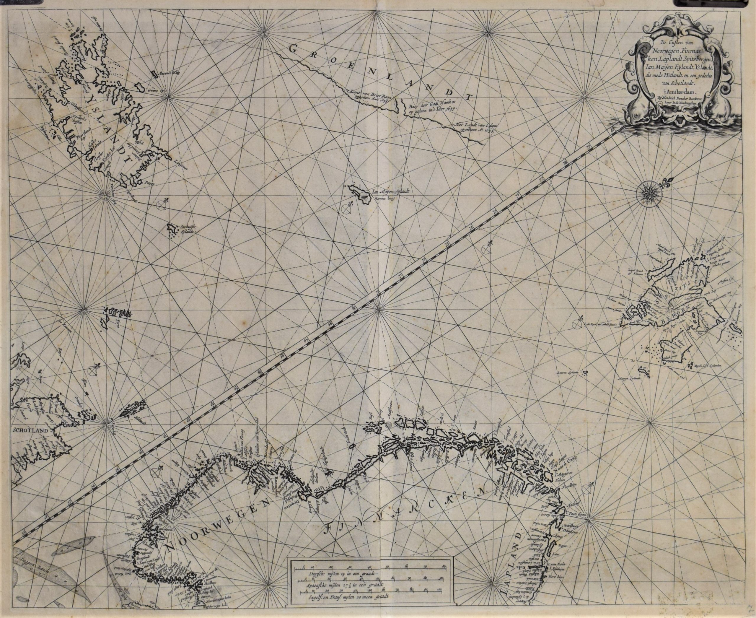
Doncker, H.: De Custen Van Noorwegen, Finmarken, Laplandt … Yslandt (1660)
€750,00
Description
Hendrick Doncker (1626-1699)
De Custen Van Noorwegen, Finmarken, Laplandt … Yslandt
17th century sea chart of the Arctic Ocean with the coastline of northern Scandinavia, Scotland, Iceland, Spitzbergen (Svalbard) and Jan Mayen Island. Also part of the coast of Greenland is depicted on the map.
Copper engraving with decorative cartouche and a compass rose.
Interesting map with place names among the coastlines.
Additional information
YEAR OF PUBLICATION:
ca. 1660
PLACE OF PUBLICATION:
Amsterdam
Condition:
Good condition
Dimensions:
44,5 x 55 cm
Technique:
Copper engraving


