Shipping
Shipping is not included in the prices. The fee will be confirmed to the customer by a separate e-mail and depends on the parcel's size and destination.
Examples: Finland 5,90€; Sweden, Germany, Baltics 8,00€; Benelux, Denmark, Spain 12,00€; Non-EU 35,00€
terms & conditions
Before ordering we kindly ask you to read our terms and conditions.
availability
The selection of our online store is not available at the bookstore. If you wish to view some items, please contact us in advance.
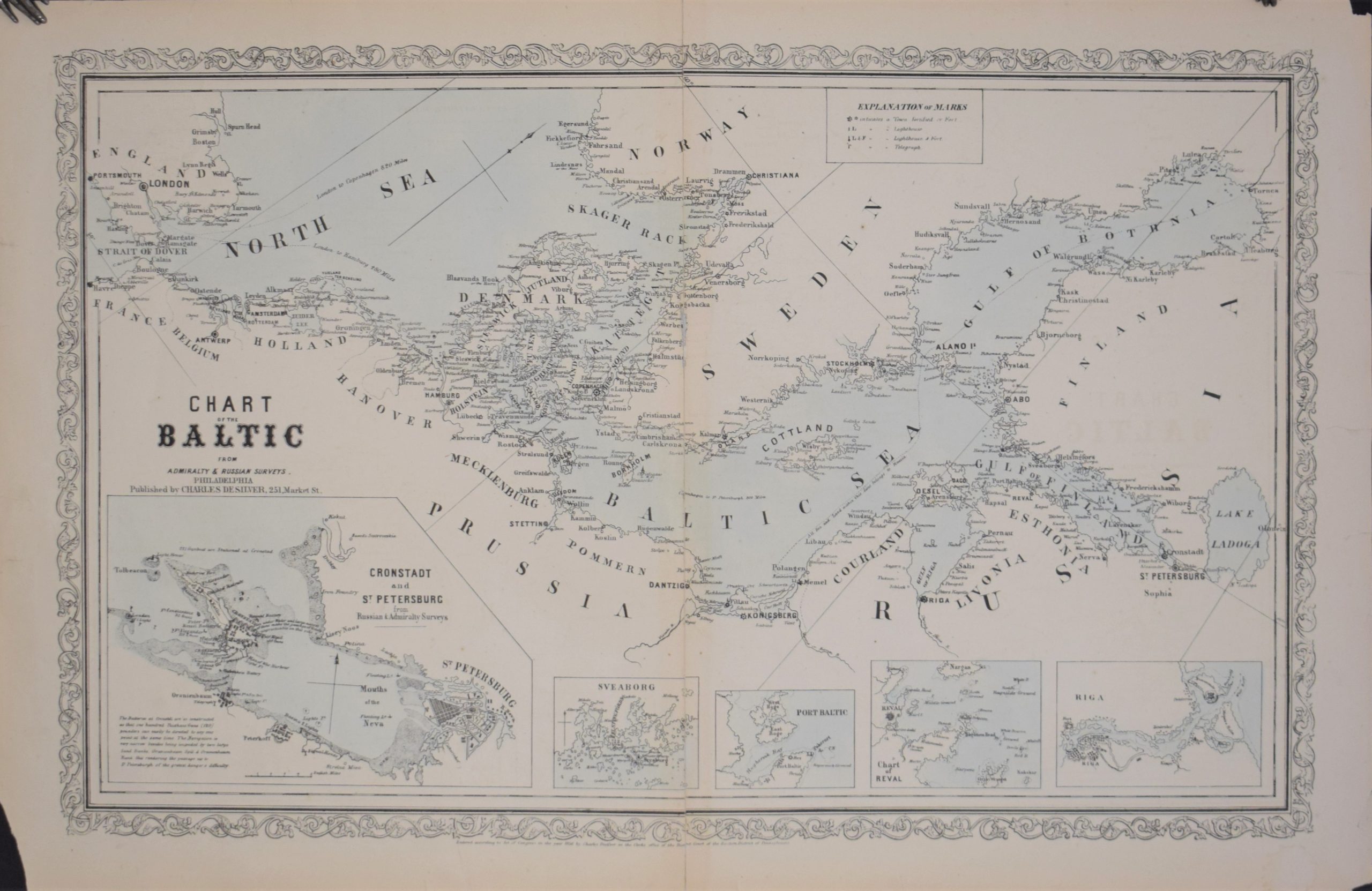
Desilver, Charles: Chart of the Baltic From Admiralty & Russian Surveys (1856)
€220,00
1 in stock
Description
Charles Desilver
Chart of the Baltic From Admiralty & Russian Surveys
Philadelphia, 1856. Size 38,5 x 60,5 cm.
Old map of the Baltic Sea. Lithographic print from 1856. Decorative borders. Five small insert maps: Cronstadt & St.Petersburg, Sveaborg, Port Baltic, Chart of Reval and Riga.
Good overall condition. Some tears in the margins.
Additional information
YEAR OF PUBLICATION:
1856
PLACE OF PUBLICATION:
Philadelphia
Dimensions:
38,5 x 60,5 cm


