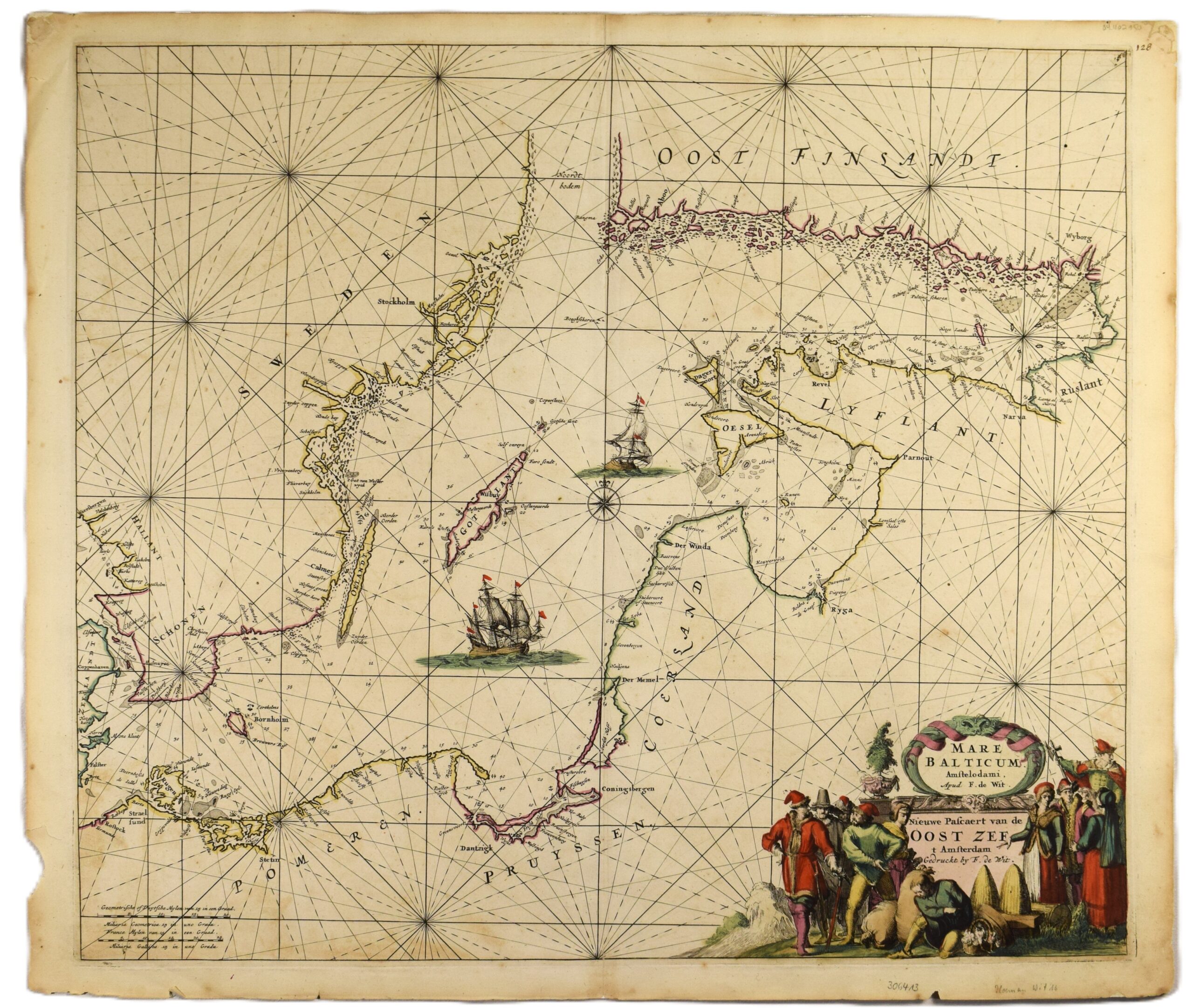
DE WIT: Sea chart of the Baltic Sea (1675)
€2.000,00
1 in stock
Frederick de Wit (1629 – 1706)
Mare balticum Amstelodami. Apud F. De Wit. Nieuwe Pascaert van de Oost Zee.
Se chart of the Baltic sea | Itämeren merikortti | Sjökort över Östersjön
17th century Dutch sea chart of the Baltic Sea by Frederick de Wit, published in Amsterdam in 1675. A copperplate engraving with hand-coloured outlines and a magnificent title cartousch. De Wit’s cartographical copperplates were of such high quality that they remained in use for a century, later being reissued by Louis Renard and and J. Ottens.
The map depicts the Baltic Sea, streching from the Danish Straits in the west to the city of Vyborg in the east. Many coastal cities, navigational landmarks, and islands are detailed along the shores. The Åland islands are integrated into the Finnish archipelago.
The map is decorated in typical de Wit style: an impressive title cartouche, large detailed sailing vessels and a prominent compass rose.
The map is in good overall condition with vibrant colours. Some age-related toning and occasional foxing. The edges of the margins are creased on some parts, though this does not affect the printed image.
- Condition: Good condition. Some toning and foxing. Margins partially creased.
- Dimensions: 53 x 62 cm
Note to nearby customers: A custom-made silver frame is available for this map at no extra cost. Please note that the frame is for local pick-up only from Helsinki and cannot be shipped.
Suomeksi:
Frederick de Witin merikortti Itämerestä vuodelta 1675. Amsterdamissa painettu käsinväritetty kuparipiirros, joka on peräisin de Witin merikartastosta. Kartassa näkyy Itämeri Tanskan salmista Viipuriin. Ahvenanmaa esitetty osana Turun saaristoa. Merikortin kartushi on de Witille tyypillisesti mahtipontinen. Karttakuvassa nähtävillä muitakin klassisia hollantilaisia piirteitä, kuten yksityiskohtaisia laivoja sekä kompassiruusu. Kartan yleiskunto on hyvä ja värit kirkkaat. Aavistuksen verran tummumista ja muutamia pieniä läikkiä. Marginaalien reunat paikoitellen rispaantuneet.
- Kunto: Hyvä kunto. Paikoittaista tummumista ja läikkiä. Marginaalien reunat kuluneet.
- Mitat: 53 x 62 cm
Huom! Tähän karttaan on saatavilla mittojen mukaan tehty hopeinen kehys ilman lisähintaa. Huomioithan, että kehys on saatavilla vain noudettuna Helsingistä, eikä sitä voida lähettää postitse.
På svenska:
Ett 1600-tals sjökort över Östersjön av Frederick de Wit. Handkolorerat kopparstick, tryckt i Amsterdam 1675. Denna karta kommer från den de Wits sjöatlas. Kartbilden visar Östersjön, från Öresund till Viborg, med Åland integrerat i Åbo skärgård. Sjökortet är dekorerat i typiskt de Wit-stil med en imponerande titelkartusch, detaljerade segelfartyg och en vindros. Kartan är i bra skick. Ålderspatina och enstaka små fläckar. Marginalerna är delvis veckade, vilket inte påverkar själva kartbilden.
- Skick: Gott skick. Ålderspatina och enstaka små fläckar. Yttre marginalerna delvis veckade.
- Mått: 53 x 62 cm
Obs! En måttbeställd silverram är tillgänglig för denna karta utan extra kostnad. Observera att ramen endast är tillgänglig för avhämtning i Helsingfors och kan inte skickas per post.
***
Fredrick de Wit (1629 – 1706) was one of the most famous map engraver of the second half of the 17th century. He was born in Gouda but based in Amsterdam where his work work encompassed the full range of cartographic production, including sea and world atlases, wall maps and town books. In 1688 de Wit obtained a priviledge from the States General to publish his maps; all his atlases after this date carry the marking ‘cum privilegio’.
(References: Koeman, Tooley’s)


