Shipping
Shipping is not included in the prices. The fee will be confirmed to the customer by a separate e-mail and depends on the parcel's size and destination.
Examples: Finland 5,90€; Sweden, Germany, Baltics 8,00€; Benelux, Denmark, Spain 12,00€; Non-EU 35,00€
terms & conditions
Before ordering we kindly ask you to read our terms and conditions.
availability
The selection of our online store is not available at the bookstore. If you wish to view some items, please contact us in advance.
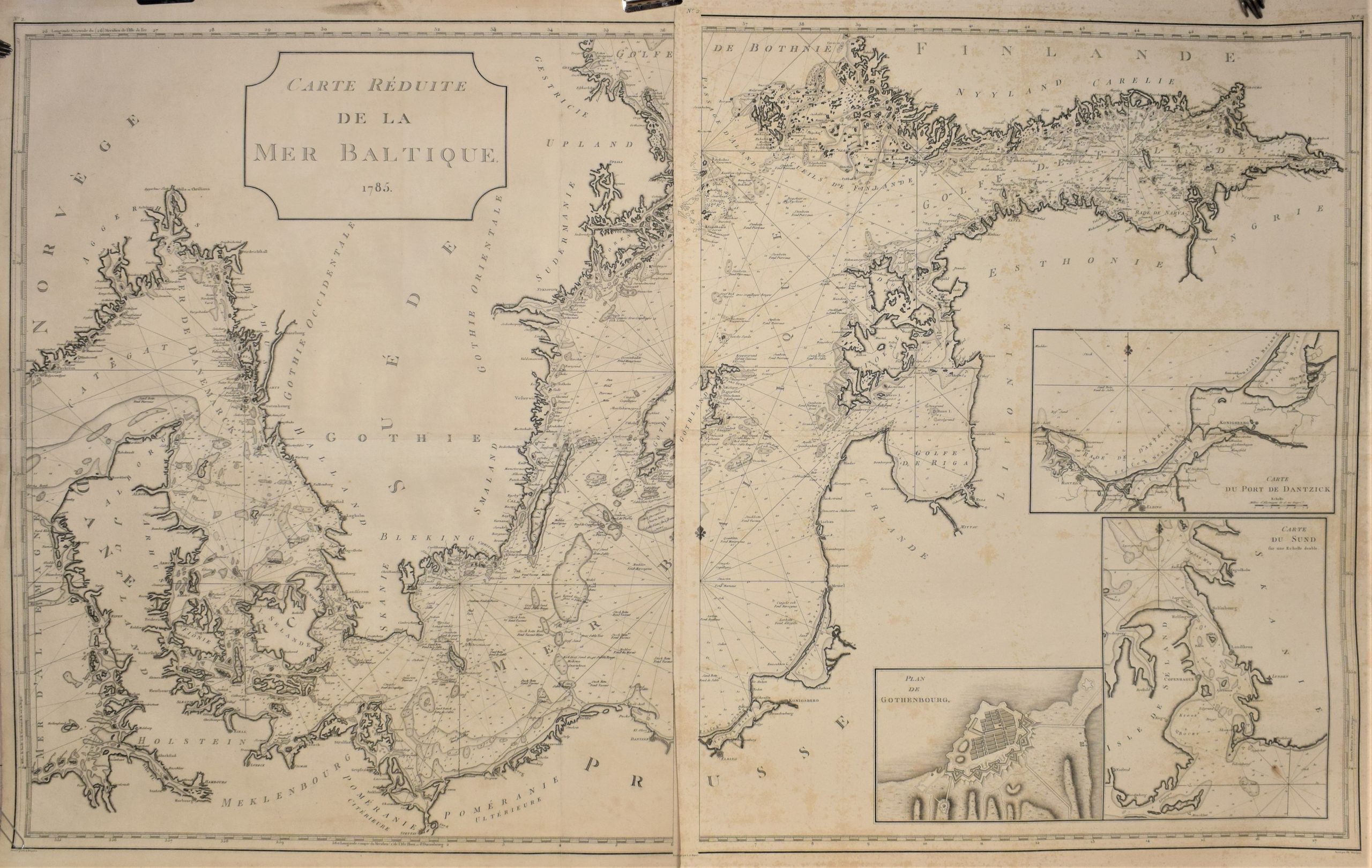
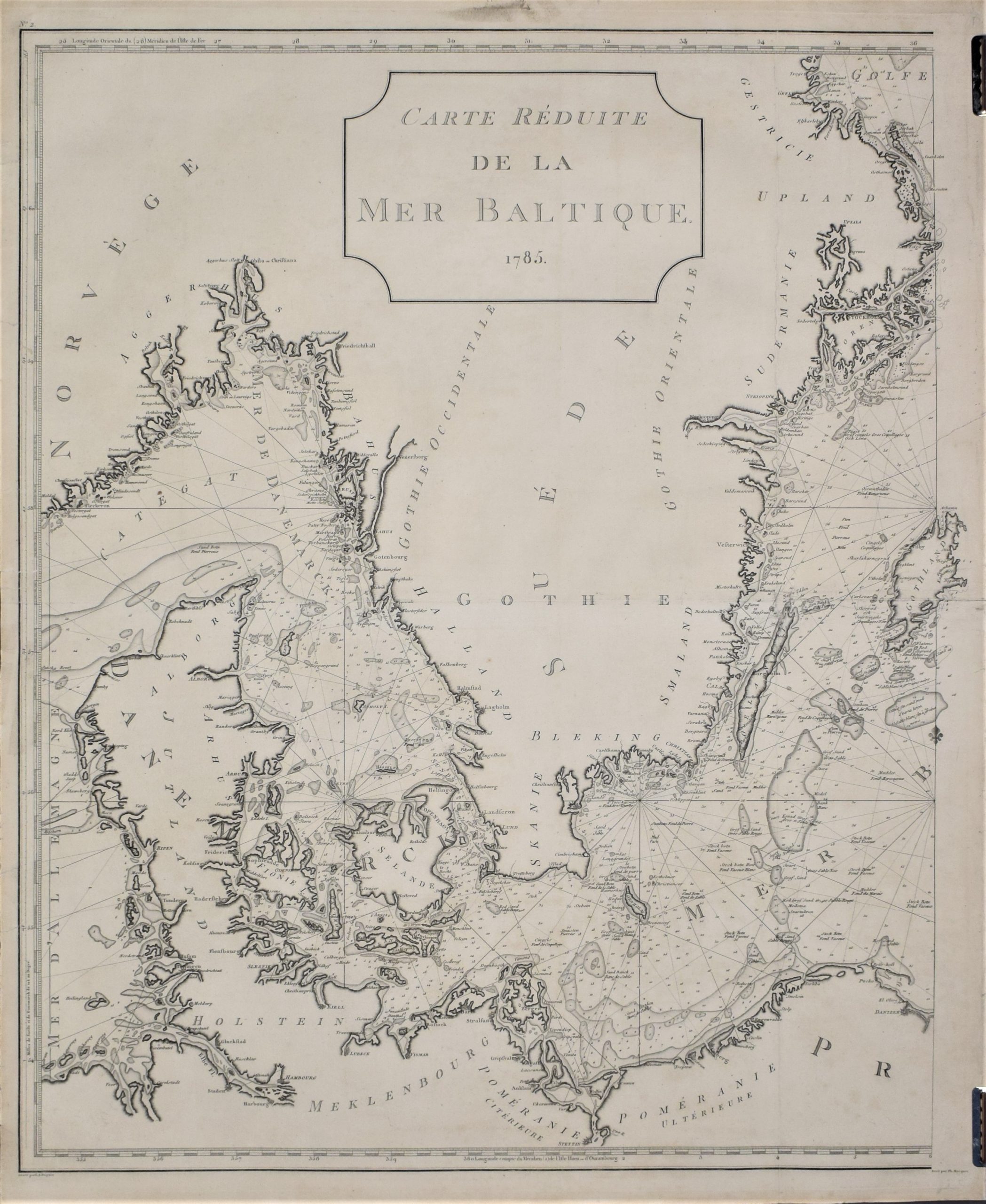
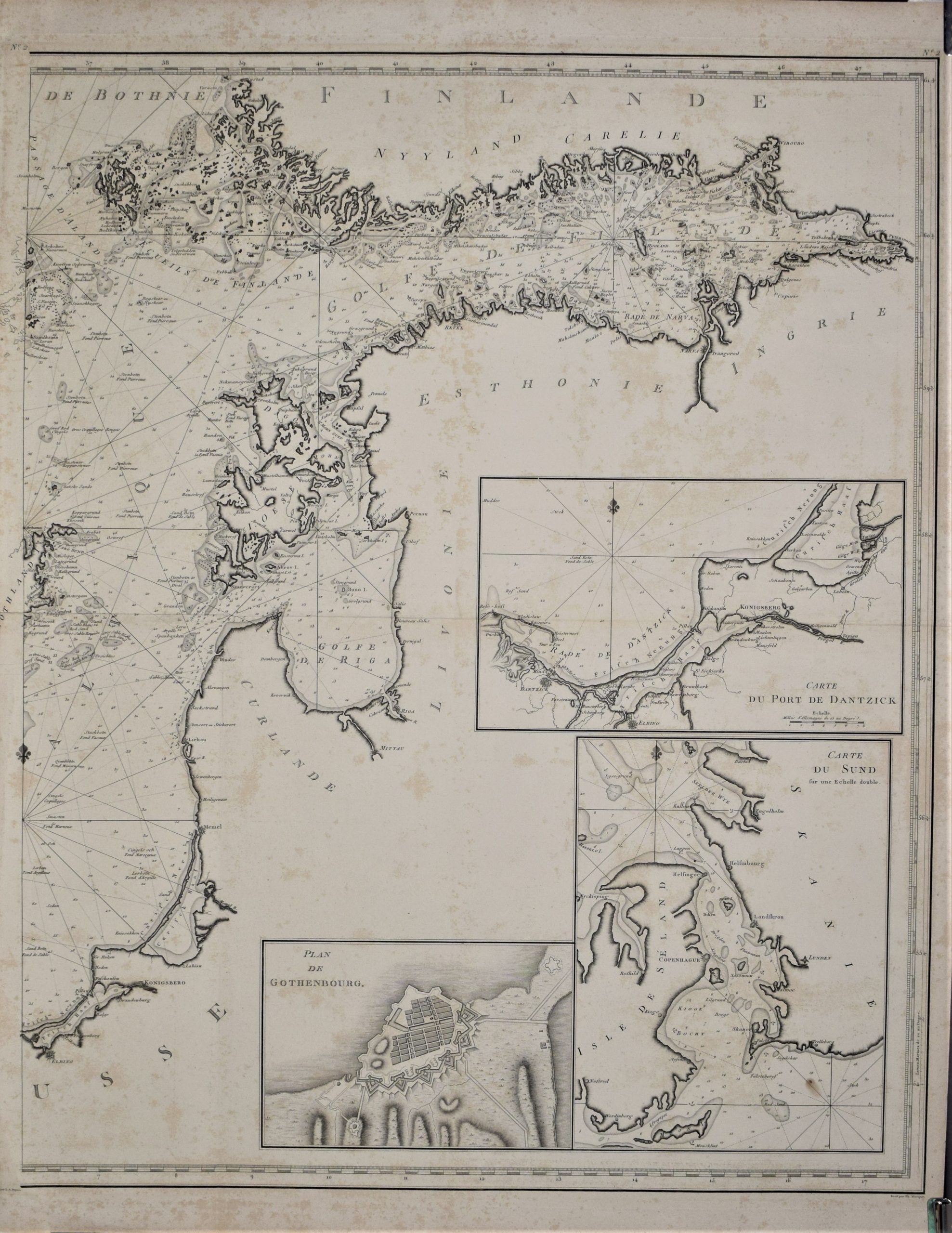
Carte Réduite de la Mer Baltique 1785
€2.800,00
Description
Louis André Dupuis, Ph. Macquet
Carte Réduite de la Mer Baltique 1785
Paris, 1785.
Large two-sheet map of Baltic Sea from 1785. Uncoloured copper engraving.
The map depicts the area from Skagerrak to St. Petersburg. Large cartouche and three inset maps of Gothenburg (Plan de Gothenbourg), Sund (Carte du Sund) and Danzig (Carte du port de Dantzick). Detailed map with place names along the coastlines.
The two sheets are separate. Sheet showing the eastern parts has some browning and foxing on the image.
Additional information
YEAR OF PUBLICATION:
1785
PLACE OF PUBLICATION:
Paris
Condition:
Occasional browning and foxing
Dimensions:
Each sheet: 76 x 63 cm
Technique:
Copper engraving


