Shipping
Shipping is not included in the prices. The fee will be confirmed to the customer by a separate e-mail and depends on the parcel's size and destination.
Examples: Finland 5,90€; Sweden, Germany, Baltics 8,00€; Benelux, Denmark, Spain 12,00€; Non-EU 35,00€
terms & conditions
Before ordering we kindly ask you to read our terms and conditions.
availability
The selection of our online store is not available at the bookstore. If you wish to view some items, please contact us in advance.
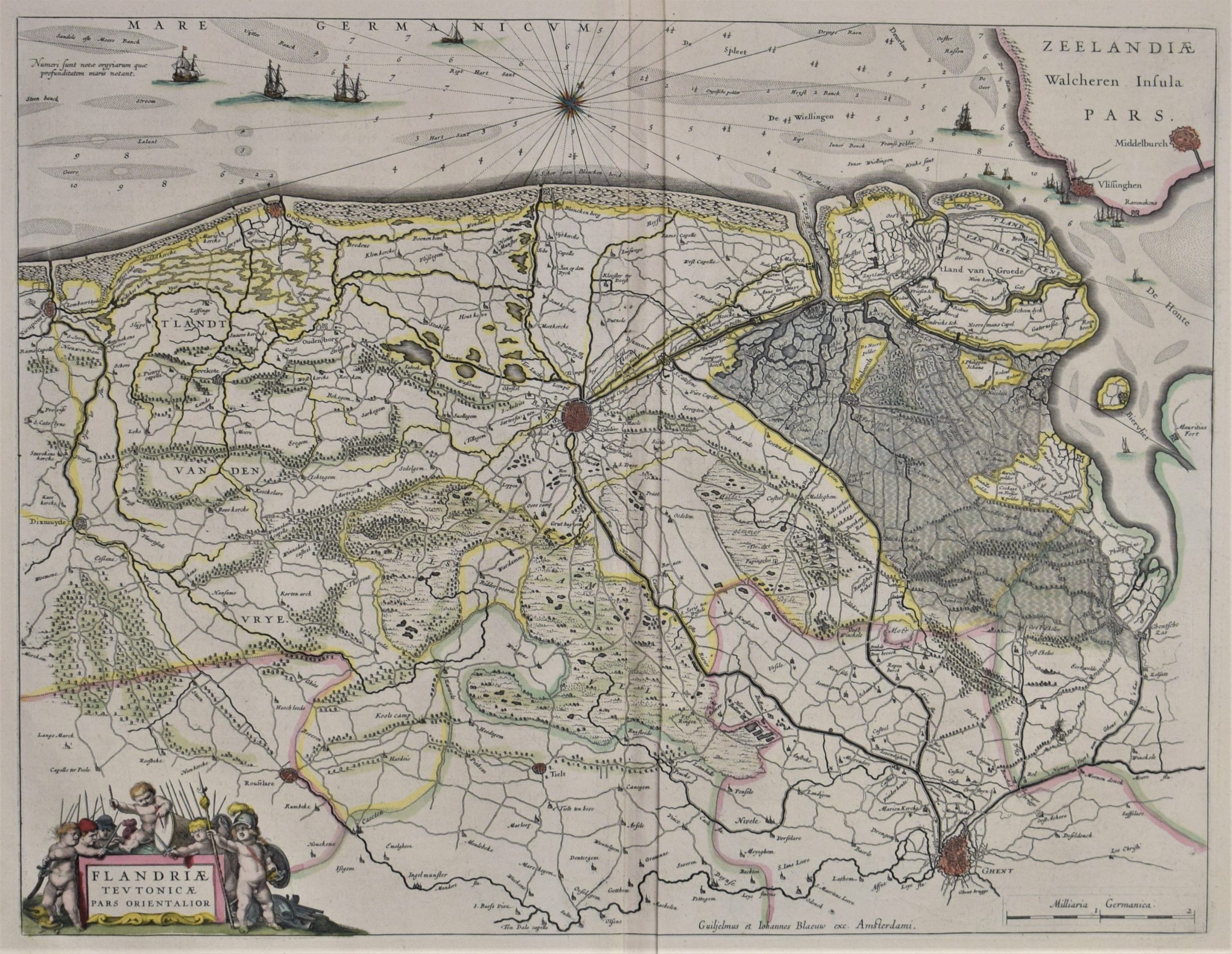
Belgium. Blaeu, W. J.: Flandriae Teutonicae pars Orientalior (1647)
€400,00
Description
Willem Janszoon Blaeu (1571-1638)
Flandriae Teutonicae pars Orientalior
17th century map of the northernmost West Flanders in Belgium. The map is centered in Bruge. Ghent in the right corner.
Hand-coloured copperplate engraving. Decorative cartouche, compass rose and naval ships. West oriented map.
Good condition with bright colours. There are two old stamps in the lower margin but they are not affecting the image.
Additional information
YEAR OF PUBLICATION:
1647, German edition
PLACE OF PUBLICATION:
Amsterdam
Condition:
Good condition
Dimensions:
38 x 50 cm
Technique:
Hand-coloured copper engraving


