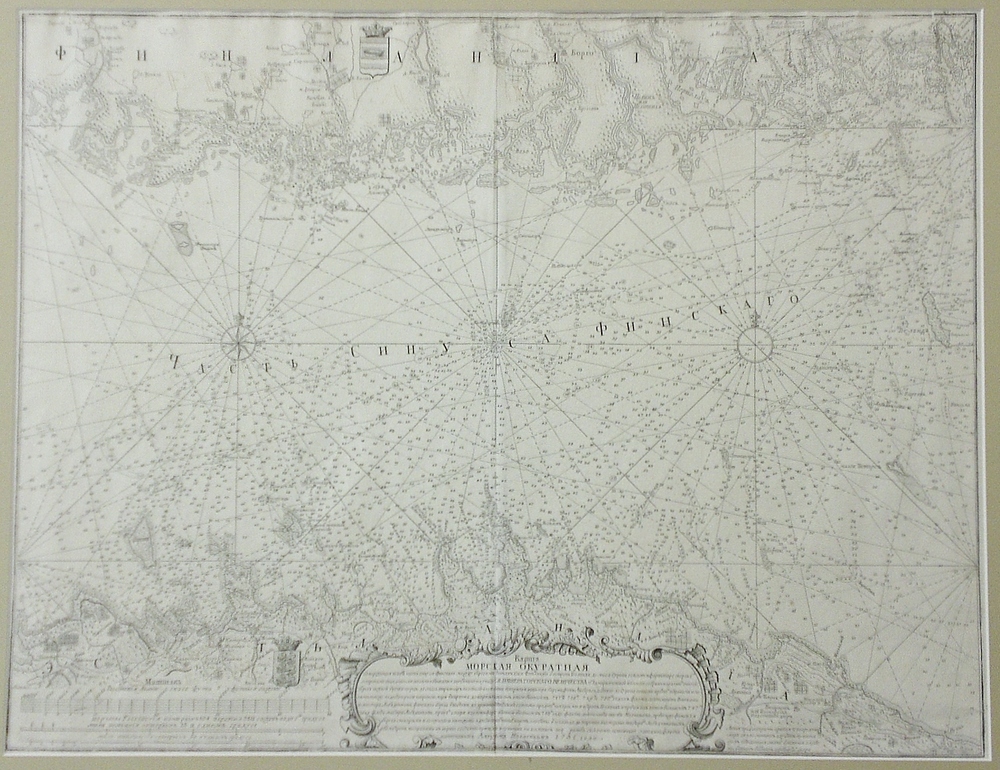
[18th century] Nagaev, A.I.: Middle part of the Gulf of Finland (1751)
€1.500,00
Alexey Ivanovich Nagaev (Алексей Иванович Нагаев) (1704-1780)
Karta Morskaya Okuratnaya...
Russian engraved sea chart of the Gulf of Finland showing the middle part of the Gulf of Finland with Finnish and Estonian coastline. The Finnish coastline depicts the area between Porkkala peninsula and Kotka with Helsinki in the middle. On the Estonian coastline, Tallinn is marked in the middle.
Venäläinen Nagajevin merikortti Suomenlahden keskiosasta vuodelta 1751. Suomen rannikolla alue Porkkalan ja Kotkan välillä. Viron rannikolla erottuu mm. Tallinna. Yksityiskohtainen kuparipiirros, jossa saaret piirretty tarkkaan ja vesialueilla syvyyslukemia. Kartan on laatinut venäläinen amiraali Alexander Nagajev. Kartan tekstit ovat venäjäksi.
Ryskt sjökort över mellersta delen av Finska viken med Finlands och Estlands kust. Finska kusten är mellan Porkala och Kotka med Helsingfors i mitten. Detaljerad karta med öarna och djup. Kopparstick. Kartan är uppgjort av ryska admiralen Alexander Nagajev. Texterna på ryska.


