Shipping
Shipping is not included in the prices. The fee will be confirmed to the customer by a separate e-mail and depends on the parcel's size and destination.
Examples: Finland 5,90€; Sweden, Germany, Baltics 8,00€; Benelux, Denmark, Spain 12,00€; Non-EU 35,00€
terms & conditions
Before ordering we kindly ask you to read our terms and conditions.
availability
The selection of our online store is not available at the bookstore. If you wish to view some items, please contact us in advance.
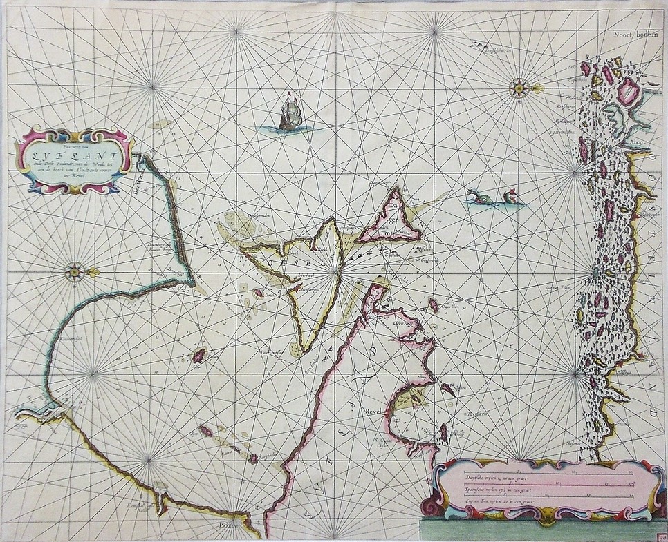
[17th century] Theunis, J.: Pascaert van Lyflant ende Oost-Finlandt (1667)
€800,00
Description
J. Theunis – Lootsman, Jacob & C. (publ.)
Pascaert van Lyflant ende Oost-Finlandt, van der Winda tot aen de hoeck van Alandt ende voort tot Revel
17th century Dutch sea map of the Gulf of Finland showing Balticum and the South coast of Finland including Åland islands. West-up map orientation.
Copper engraving with hand-coloured outlines. Good condition. Framed in passepartout.
Additional information
YEAR OF PUBLICATION:
1667
Condition:
3
Condition explanations:
(5) Mint, (4) Very good, (3) Good, (2) Fair, (1) Poor
Dimensions:
43,5x52,5


