Shipping
Shipping costs are not included in the prices. We will send you a separate email to confirm the shipping fee, which depends on your location and the package size.
Examples: Finland 6,00€; Sweden, Germany, Baltics 10,00€; Benelux, Denmark, Spain 12,00€; Non-EU 35,00€
terms & conditions
Before ordering we kindly ask you to read our terms and conditions.
availability
Our online selection is stored separately. To view an item at the bookstore, please contact us ahead of your visit.
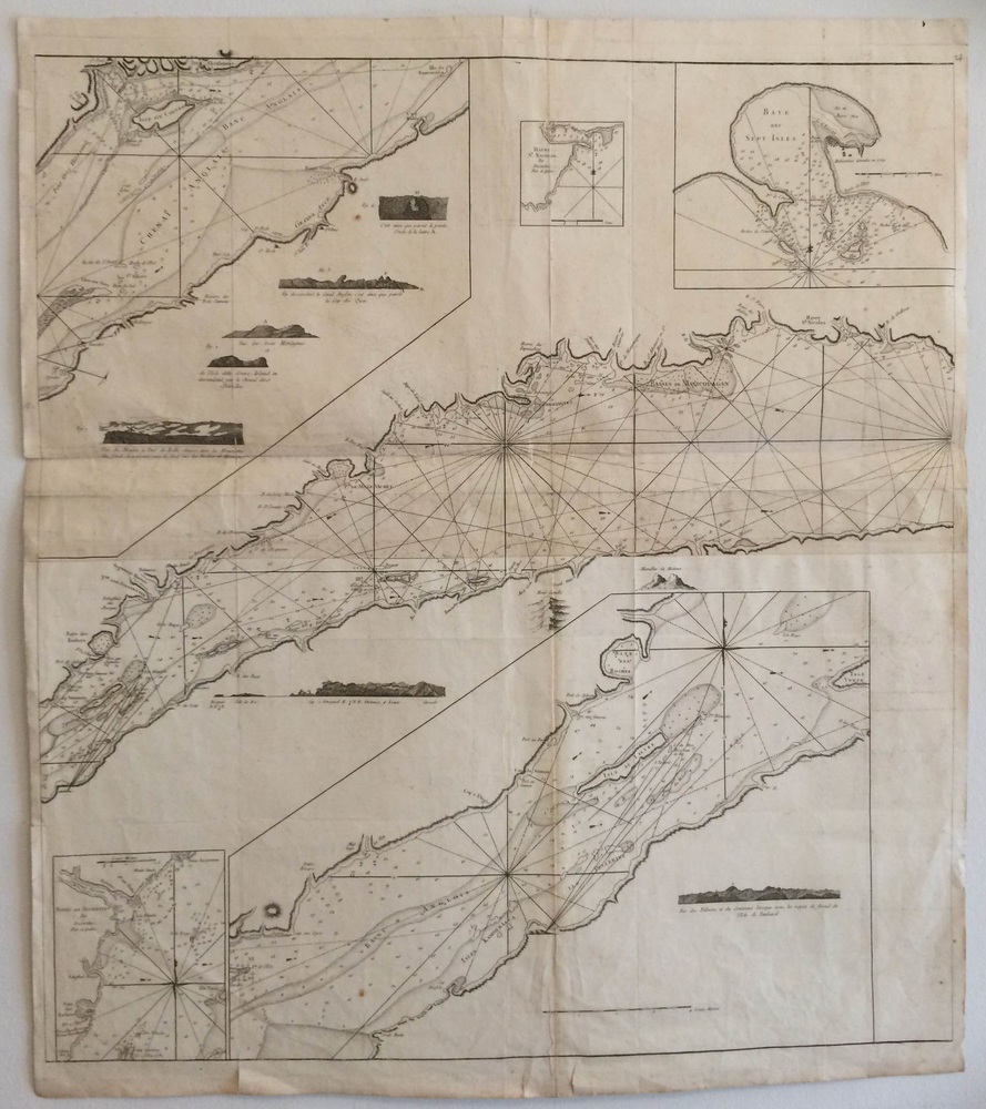
Nautical chart of St. Lawrence River Quebec (1790)
€1.200,00
Description
18th century nautical chart of St. Lawrence River, Quebec, Canada
Uncoloured copper engraving. Place names in French.
The map is worn, some small tears in the margins. Partly restored.
Additional information
YEAR OF PUBLICATION:
1790
Illustrations:
mustavalkoinen / okolorerad / uncoloured
Condition:
3, kulunut, marginaaleissa pieniä repeämiä, osittain restauroitu / sliten, några små revor i marginalerna, delvis restaurerad / worn, small tears in the margins, partly restaured
Condition explanations:
(5) Mint, (4) Very good, (3) Good, (2) Fair, (1) Poor
Dimensions:
85 x 78 cm
Technique:
kuparipiirros / kopparstick / copper engraving
Other:
Ranskankielinen / franskspråkig / in french


