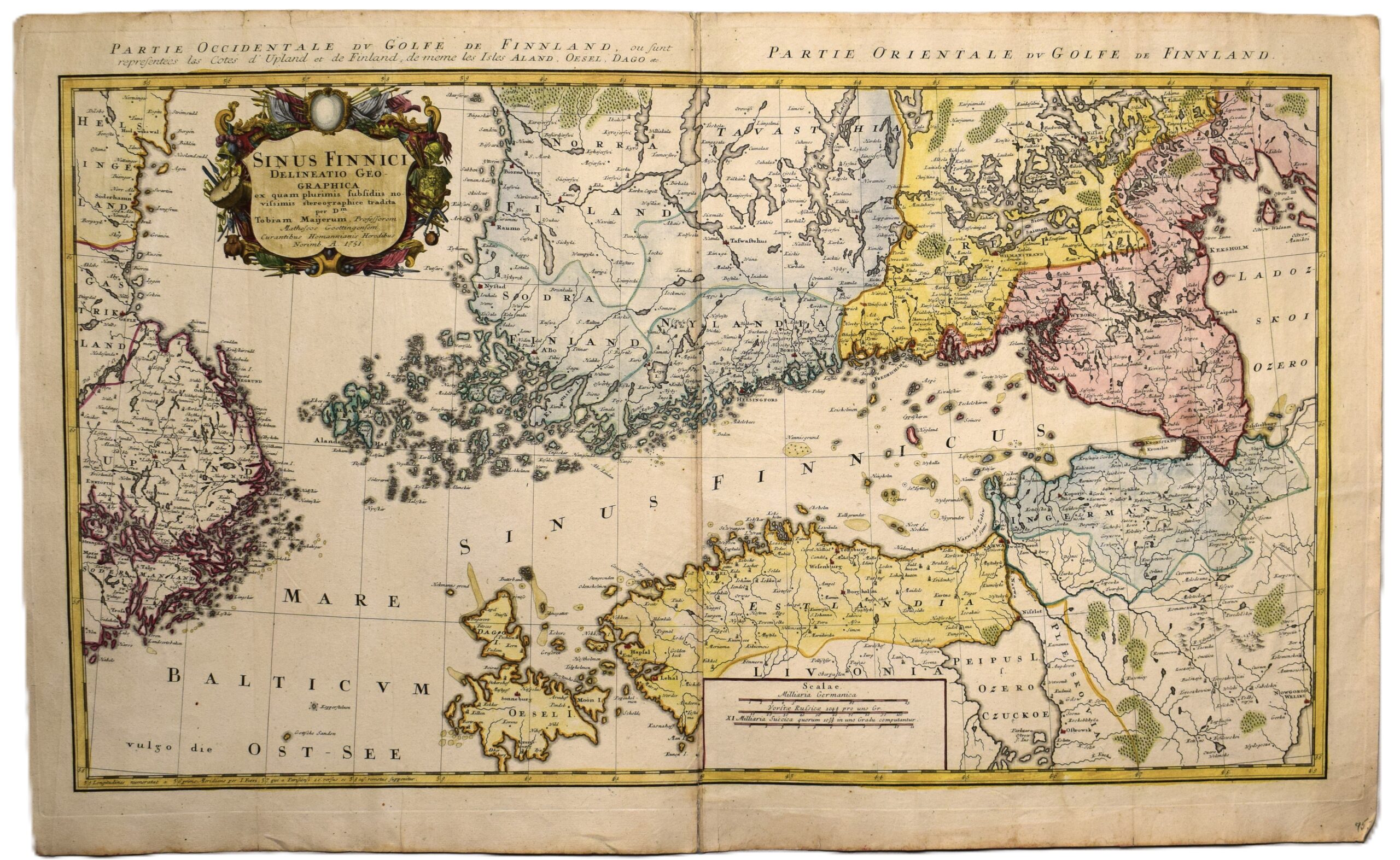
TOBIAS MAYER: Map of the Gulf of Finland – Sinus Finnici Delineatio Geographica (1751)
€650,00
1 in stock
Tobias Mayer (1723-1762) – Homann Heirs
Sinus Finnici Delineatio Geographica ex quam pluriminis subsidiis novissimis stereographice tradita per Dm. Tobiam Majerum
An original 18th century map of the Gulf of Finland by the German cartographer and astronomer Tobias Mayer, published in 1751 by the Homann Heirs in Nuremberg. This copperplate engraving features well-preserved, authentic hand-colouring. The map is a large-format work, printed on two joined sheets of thick paper with clearly visible watermarks.
This map provides a detailed view of the Gulf of Finland, showcasing accurate depictions of the Finnish and Estonian coastlines. The coverage extends to the Åland islands, Dagö (Hiiumaa), and Ösel (Saaremaa), reaching as far west as the Stockholm archipelago and the eastern shores of Sweden. This is an informative map with place names and administrative borders. The monumental title cartouche is decorated with military iconography.
A beautiful example in good overall condition. Vibrant colouring. The paper show only light age-related toning.
- Condition: Good condition.
- Dimensions: 50 x 84 cm
Suomeksi:
Alkuperäinen 1700-luvun kartta Suomenlahdesta. Kartan on tehnyt saksalainen Tobias Mayer ja sen on julkaissut Homann Heirs Nurnbergissä vuonna 1751. Käsinväritetty kuparipiirros. Kaksi yhteenliitettyä arkkia. Karttakuvassa näkyy koko Suomenlahti; Suomen ja Viron rannikot, Ahvenanmaa, Saarenmaa ja Hiiunmaa sekä Ruotsin itäinen saaristo. Paljon paikannimistöä sekä hallinnolliset rajat. Suuri kartushi.
- Kunto: Hyväkuntoinen kartta, jossa kirkkaat värit. Paperissa vähäistä ajan tuomaa tummentumaa.
- Mitat: 50 x 84 cm
På svenska:
En detaljerad 1700-talskarta över Finska viken av Tobias Mayer. Utgiven av Homanns arvingar i Nurnberg, år 1751. Kartan täcker kustområdena i Finland och Estland, samt Åland, Dagö, Ösel och Stockholms skärgård. En informativ karta med administrativa gränser och ortnamn. En monumental titelkartusch med militära motiv.
- Skick: Ett vackert exemplar i gott skick med välbevarad, tidstypisk handkolorering. Lätt gulnad.
- Mått: 50 x 84 cm
***
Tobias Mayer (1723 – 1762) was a German mathematician and astronomer who worked for the Homann Heirs maphouse in Nuremberg. He discovered a means of measuring longitude at sea in 1765.
(Crf: Tooley’s)


