Shipping
Shipping costs are not included in the prices. We will send you a separate email to confirm the shipping fee, which depends on your location and the package size.
Examples: Finland 6,00€; Sweden, Germany, Baltics 10,00€; Benelux, Denmark, Spain 12,00€; Non-EU 35,00€
terms & conditions
Before ordering we kindly ask you to read our terms and conditions.
availability
Our online selection is stored separately. To view an item at the bookstore, please contact us ahead of your visit.
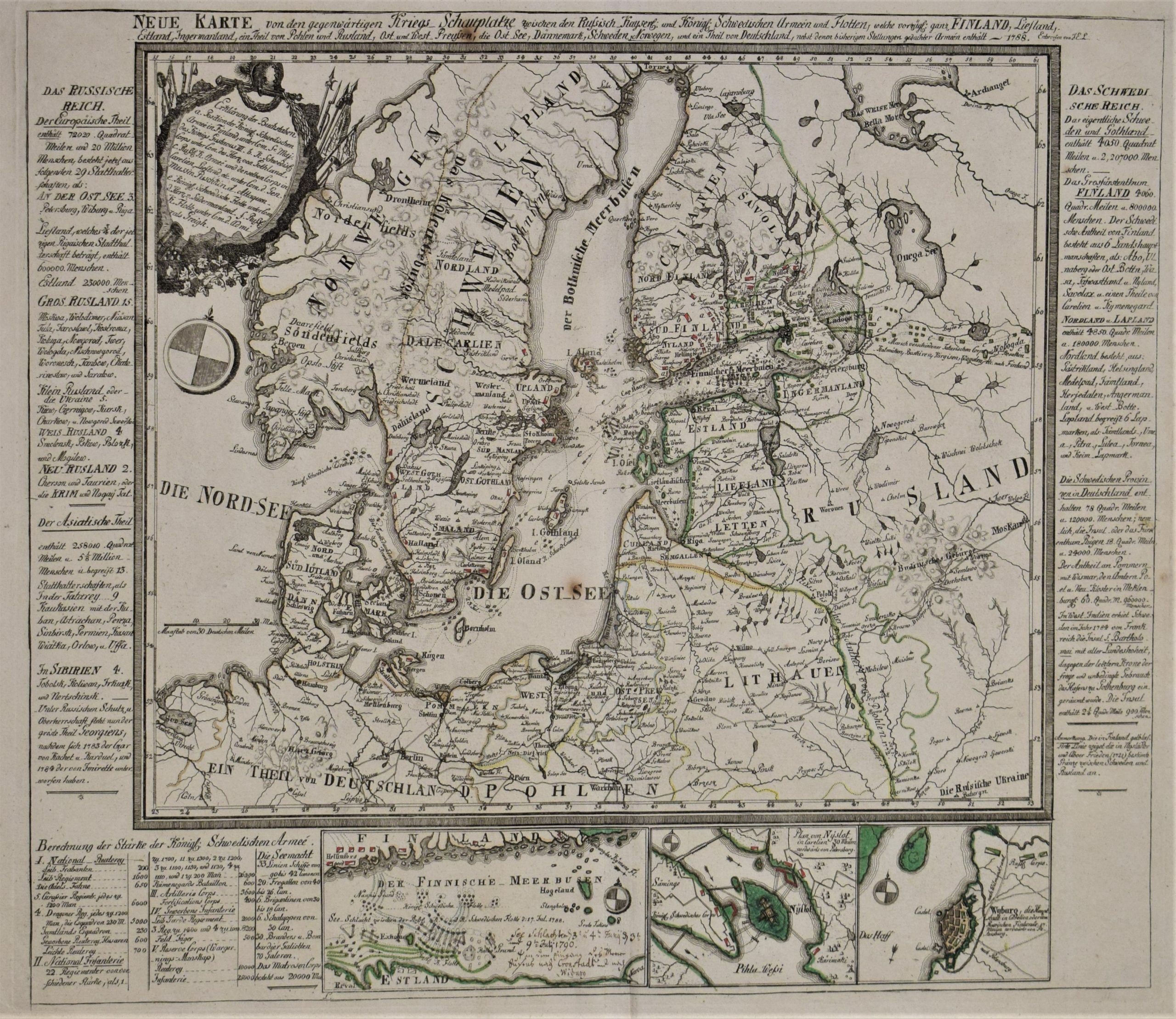
[18th century] Lange, J. E.: Neue Karte von den gegenwärtigen Kriegs-Schauplatze (1788)
€3.000,00
Description
Johann Elias Lange
Neue Karte von den gegenwärtigen Kriegs-Schauplatze zwischen den Russisch. Kayserl: und Königl: Schwedischen Armeen und Flotten, welche vorzügl. ganz Finland, Liefland, Estland, Ingermanland, ein Theil von Pohlen und Rusland, Ost- und West-Preussen, die Ost See, Dännemark, Schweden, Norwegen, und ein Theil von Deutschland, nebst denen bisherigen Stellungen gedachter Armeen enthält
Rare map of Scandinavia. Historical military map published during the Russo-Swedish War (1788-1790). Interesting map with plenty of details about the war.
Three insert maps of eastern Gulf of Finland, Savonlinna (Plan von Nyslot) and Vyborg (Wyborg).
Copper engraving with some colour. Decorative cartouche and a compass rose.
Additional information
YEAR OF PUBLICATION:
1788
PLACE OF PUBLICATION:
Leipzig
Condition:
3, good condition
Dimensions:
41,5 x 48,5 cm
Technique:
Copper engraving


