Shipping
Shipping costs are not included in the prices. We will send you a separate email to confirm the shipping fee, which depends on your location and the package size.
Examples: Finland 6,00€; Sweden, Germany, Baltics 10,00€; Benelux, Denmark, Spain 12,00€; Non-EU 35,00€
terms & conditions
Before ordering we kindly ask you to read our terms and conditions.
availability
Our online selection is stored separately. To view an item at the bookstore, please contact us ahead of your visit.
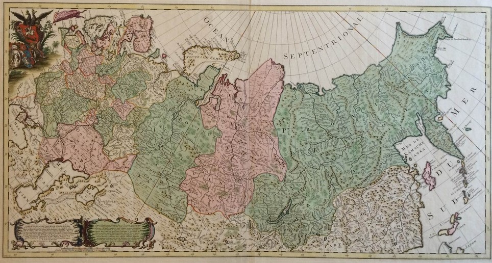
COVENS ET MORTIER: Carte générale de l’empire de Russie (1748)
€2.000,00
1 in stock
Description
JOHANNES COVENS 1697-1774); CORNELIS MORTIER (1699-1783)
Carte générale de l’empire de Russie
A mid-18th-century map of the vast Russian Empire, stretching from the Gulf of Finland and the Black Sea in the west all the way to the Bering Strait, the Kamchatka Peninsula, and the Kuril Islands in the east.
Large hand-coloured copperplate engraving consisting of two joined sheets – a grand format required to properly showcase the immense territory of the empire.
A decorative vignette in the upper left corner and two title cartouches on the lower left corner. An attractive copy.
- Condition: Good antique condition.
- Dimensions: 50 x 95,5 cm
Additional information
Publisher:
Chez Covens et Mortier
YEAR OF PUBLICATION:
1748
PLACE OF PUBLICATION:
Amsterdam
Technique:
Copper engraving


