Shipping
Shipping is not included in the prices. The fee will be confirmed to the customer by a separate e-mail and depends on the parcel's size and destination.
Examples: Finland 5,90€; Sweden, Germany, Baltics 8,00€; Benelux, Denmark, Spain 12,00€; Non-EU 35,00€
terms & conditions
Before ordering we kindly ask you to read our terms and conditions.
availability
The selection of our online store is not available at the bookstore. If you wish to view some items, please contact us in advance.
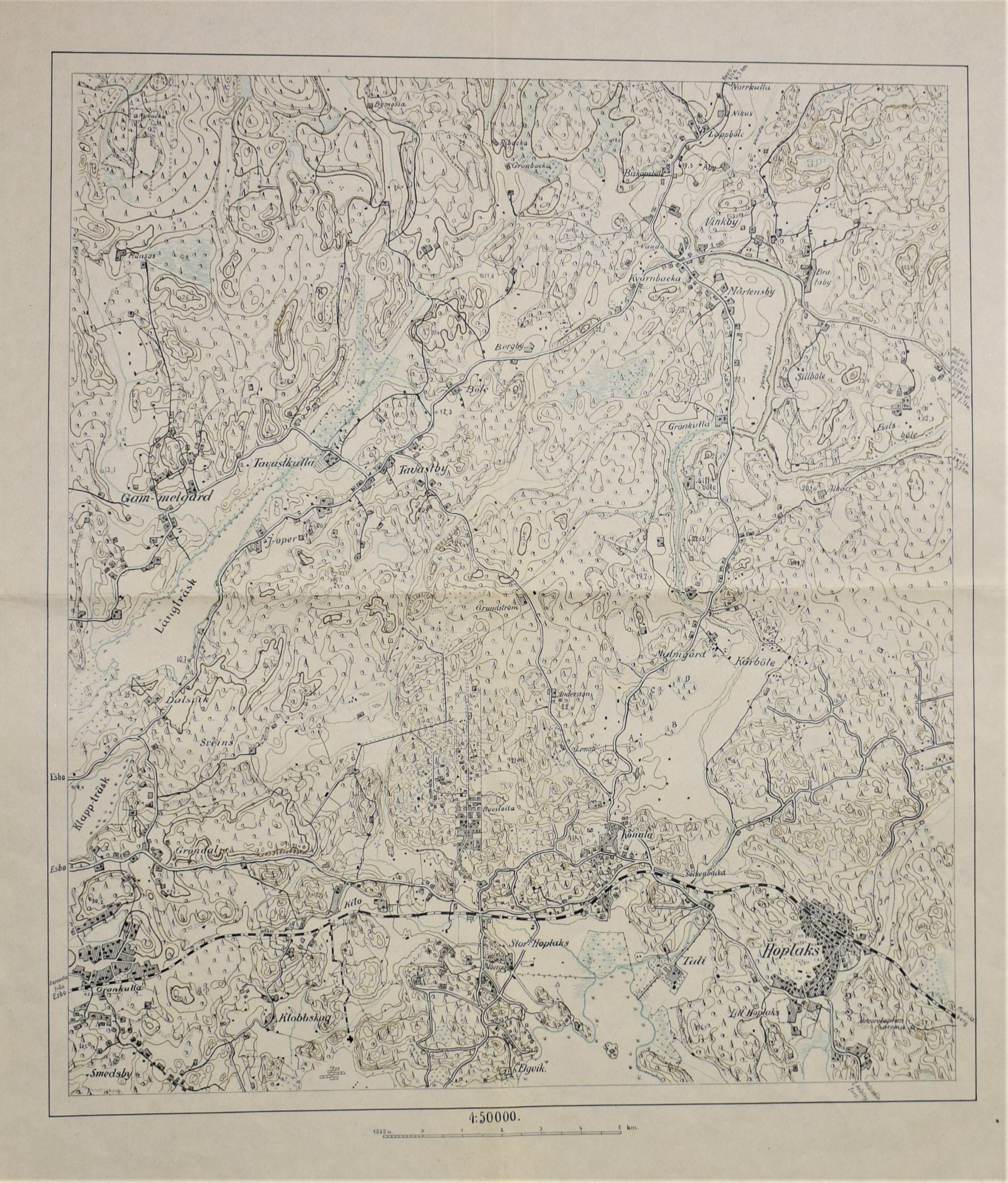
Gammelgård – Kilo – Hoplaks – topografisk karta (ca. 1930)
€180,00
Description
Topografisk karta över området: Gammelgård, Klappträsk, Grankulla, Alberga, Hoplaks, Malmgård, Konala, Tavastby, Mårtensby osv. från 1920-1930-talet.
Kartan är utan titel och alla ortnamn är bara på svenska.
Längdskala 1 : 50 000.
Mått: 56 x 47 cm
Topografikartta alueesta: Vanhakartano, Lippajärvi, Kauniainen, Leppävaara, Huopalahti, Malminkartano, Konala, Hämeenkylä, Martinlaakso jne. 1920-30-luvulta.
Karttalehdellä ei nimeä eikä painotietoja. Paikannimet vain ruotsiksi.
Pituusmittakaava 1: 50 000.
Mitat: 56 x 47 cm
Additional information


